Hic Sunt Dracones
Beyond Blender Hillshade Maps
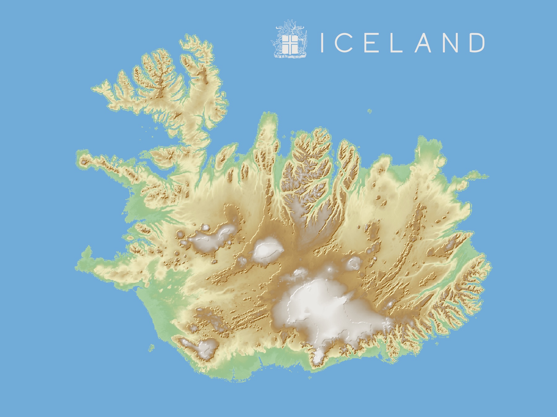
Playing with Blender and creating 3D shaded relief maps is fun. And I crafted many maps available for buy.
Next, I wanted to explore further 3D mapping styles. I tried to move beyond the usual Blender hillshade maps. Thus I researched Tanka-style maps and oblique views.
Tanaka-style Maps
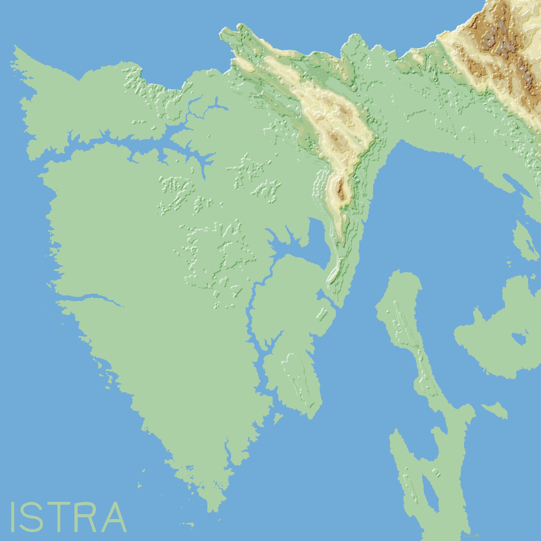
Professor Tanaka Kitiro developed the Tanaka relief contours method in 1950. “Tanaka Method” is also known as the “Illuminated Contour Method.”
There are many tutorials on How to create illuminated contours, Tanaka-style. For this particular style, you do not need to use Blender. QGIS is enough.
Large-scale maps show a smaller area with more detail. In contrast, small-scale maps show a larger area with less detail. The Tanaka-style method works best on large-scale maps for showcasing many details.
I like that Tanaka-style is immediately differentiating flat vs. hilly areas.
Oblique Views
Standard Blender shaded relief maps have an orthographic, straight-on top-down view. To make an oblique view, you need to change the camera angle. By playing with the camera, you can get a different perspective. Of course, getting the right picture takes some trial and error.
Here, terrain exaggeration is subtle and less intense than on shaded reliefs. Yet, it is still needed to get these peaks to stand out.
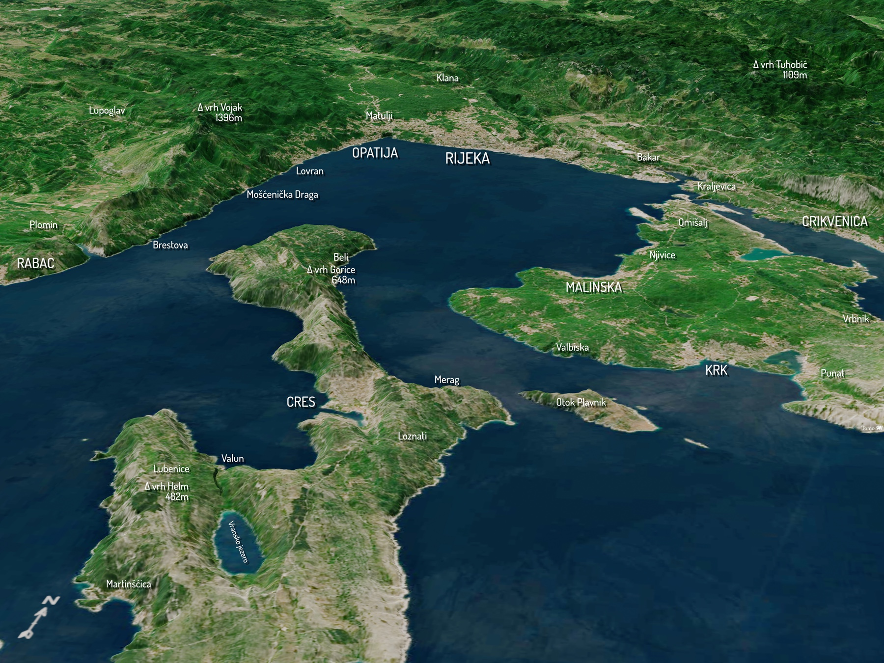
The map above shows the scenery of Rijeka and Zaljev (Croatia) from the south (SSE).
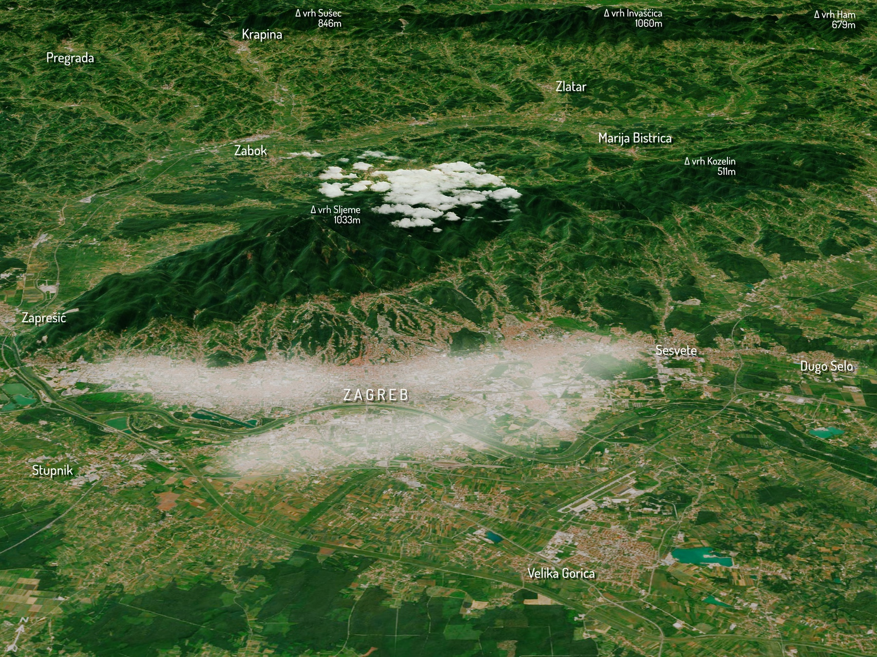
This map displays the capital of Croatia, Zagreb. Hrvatsko zagorje is in the backdrop. I added a touch of fog over the city and clouds on top of the mountain.
The last image was a byproduct while playing with (countless) Blender options. The camera view is the same but is made as an inverted depth map of a Kirsch filter used for edge detection. I like that map, as it highlights the terrain more artistically.
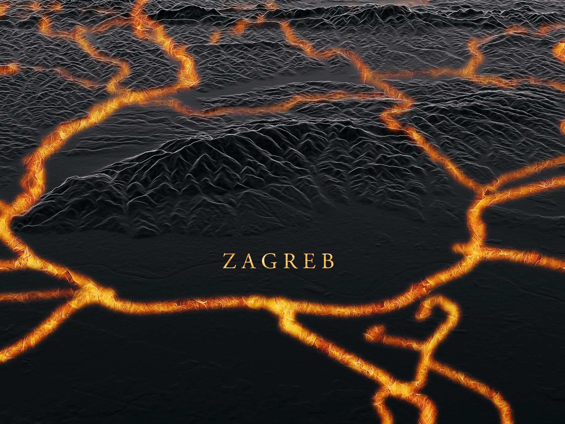
The Painted Table from Game of Thrones and House of the Dragon inspired the map. Primary state roads and highways are overlayed over inverted shaded relief and turned into a fire.
These are only a few examples of endless 3D mapping possibilities. Beyond the usual Blender hillshade maps.