Hic Sunt Dracones
Blender 3D Shaded Relief Maps
About a year ago, Velimir approached me with the idea of mashing up a geological map and a 3D shaded relief. We did it successfully, and the Twitter audience seemed to love it. It was a fun adventure, him tackling all the heavy (CPU) lifting for rendering and me helping with geo-transformations.
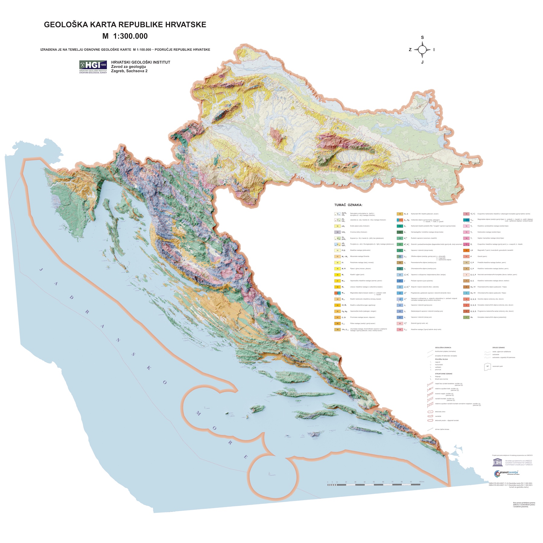
Note: You click on the maps to get a high-resolution version of the image.
Then, Velimir challenged me to pull the same trick on the ‘Europa Etnografica’ image he found on Reddit. But I needed the proper hardware for that adventure, so it all fell behind.
Then finally, in September 2022, I got some free time, and acquired a computer powerful enough to pull this off. But, in the meantime, I forgot all the steps and tricks. So, I had to remind myself of the famous Creating Shaded Relief in Blender tutorial. I will not go into nerdy details here about how I made the maps, as that tutorial covers all the basics.
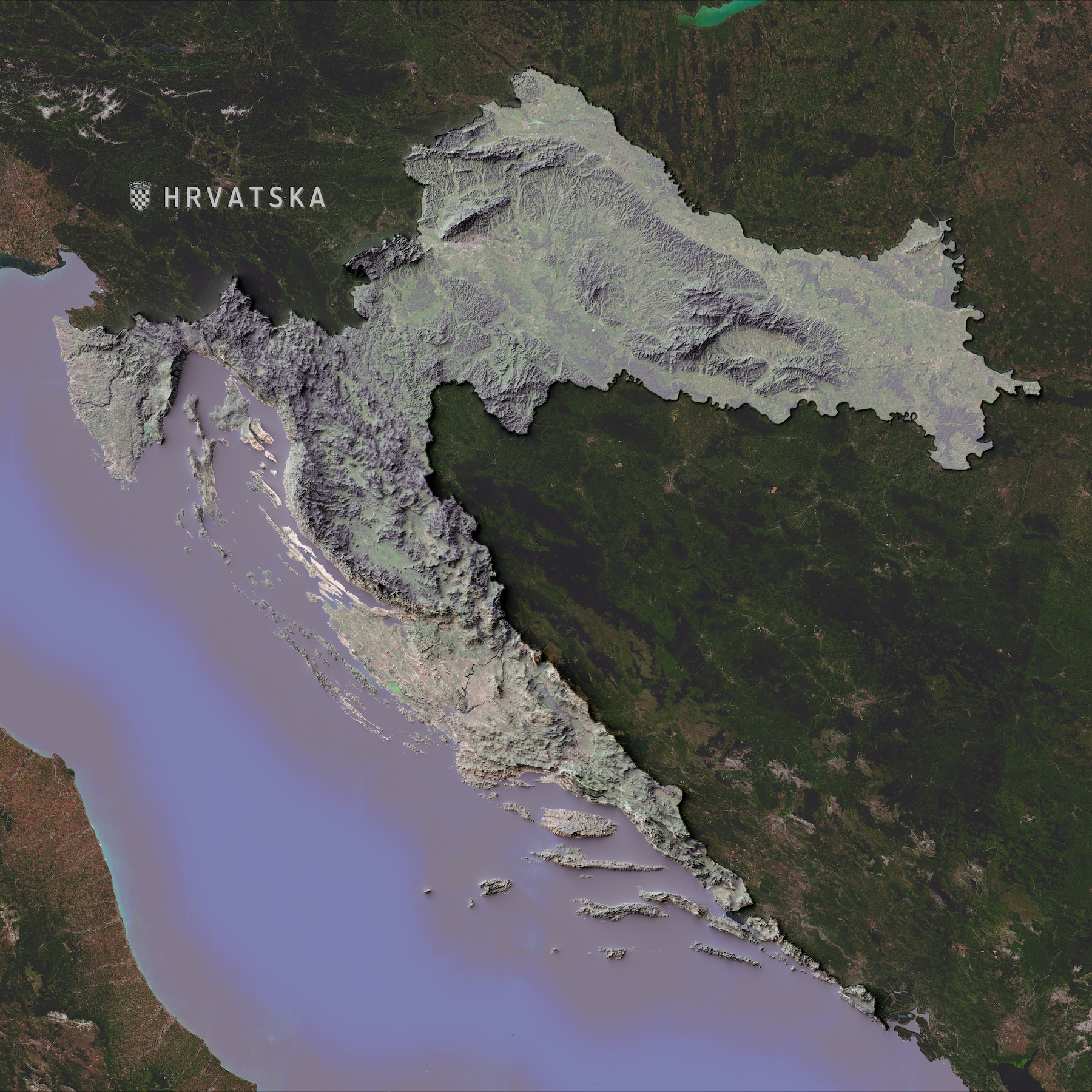
To warm up before tackling the big EU image, I started playing with a smaller area, my country Croatia. I built the DEM based on the Copernicus EU data and overlayed the Mapbox Satellite coverage. It was an easy map but was merely only a start.
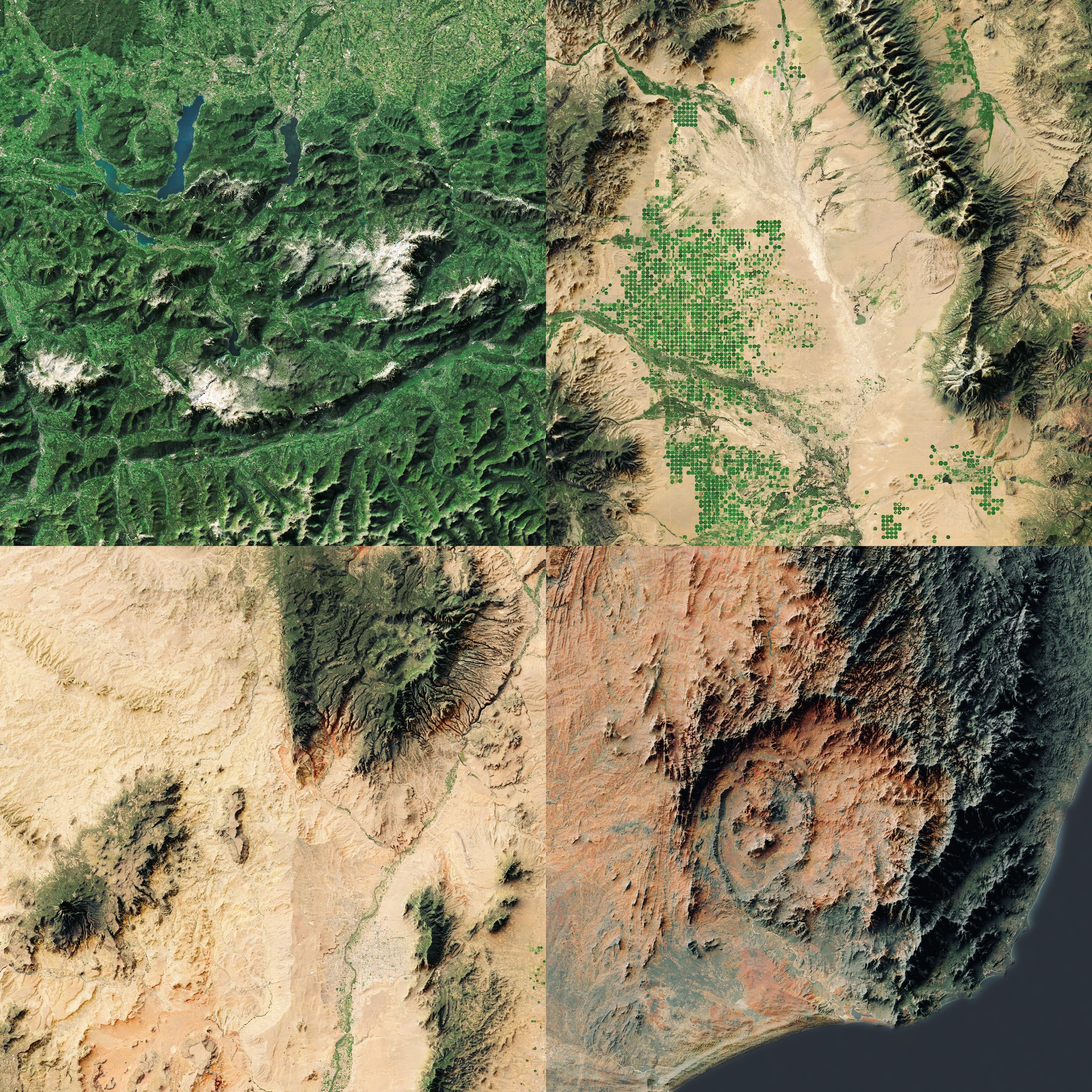
To improve the overlay, I started exploring Sentinel-2 images.
Sentinel-2 cloudless - https://s2maps.eu by EOX IT Services GmbH (Contains modified Copernicus Sentinel data 2019).
Finally, I was ready to tackle the EU map. Tho, this map came with its own set of problems. The biggest issue is the pure size of the area. I figured DEM 1.1 would be overkill, so I proceeded with version DEM 1.0 instead. Since I am doing a small-scale map of the whole of Europe, the precision of the 1.0 should be enough. Another benefit is I could download one file instead of dealing with 27 different 1000 x 1000 km tiles. Still, the file is 26GB. 😅
Once I wrangled the data and re-project it to a proper map coordinate system, I was ready to send it to Blender to do its magic.

Europa etnografica. Propr. Artistico-letteraria del T.C.I. Ufficio cartografico del T.C.I. (1929)
But this was only the beginning. I started expanding and mapping countries across Europe, the USA, and even some landmarks like the Alps.

You can check all the maps in my Etsy shop, where you can buy the printed versions if you like them.