Hic Sunt Dracones
Twitter 30DayMapChallenge 2020
In November 2020, I participated in the Twitter #30DayMapChallenge, a daily social mapping project initiated by Topi Tjukanov.
The mapping challenge’s idea is to create and publish maps based on different themes each day of the month. There are no restrictions on the tools, technologies, and data. Doing all 30 maps is not mandatory at all. Even creating one map is okay.
Honestly, doing all 30 maps in one month is quite challenging (pun intended) and time-consuming, even if you take the KISS approach. But the idea is to participate, commit as much as possible, do the best, learn something new, and most importantly - have fun.
My #30DayMapChallenge Topic
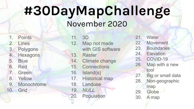
Topics for the year 2020 were as you can see in the top image.
Recently I started working on my little pet project, a repository of Formula 1™ circuits in GeoJSON format. This sparked an idea to promote the project and have an overarching theme that will simultaneously connect all the maps. The trickiest part was coming with unique ideas for each topic by utilizing track data only and doing my best not to repeat myself.
Maps
The mapping challenge initially took place on Twitter. However, I am republishing all the maps for historical purposes.
Note: You click on the maps to get a high-resolution version of the image.
Day 1 of #30DayMapChallenge : Points
Locations of F1™ circuits in Europe
 Made with D3js.
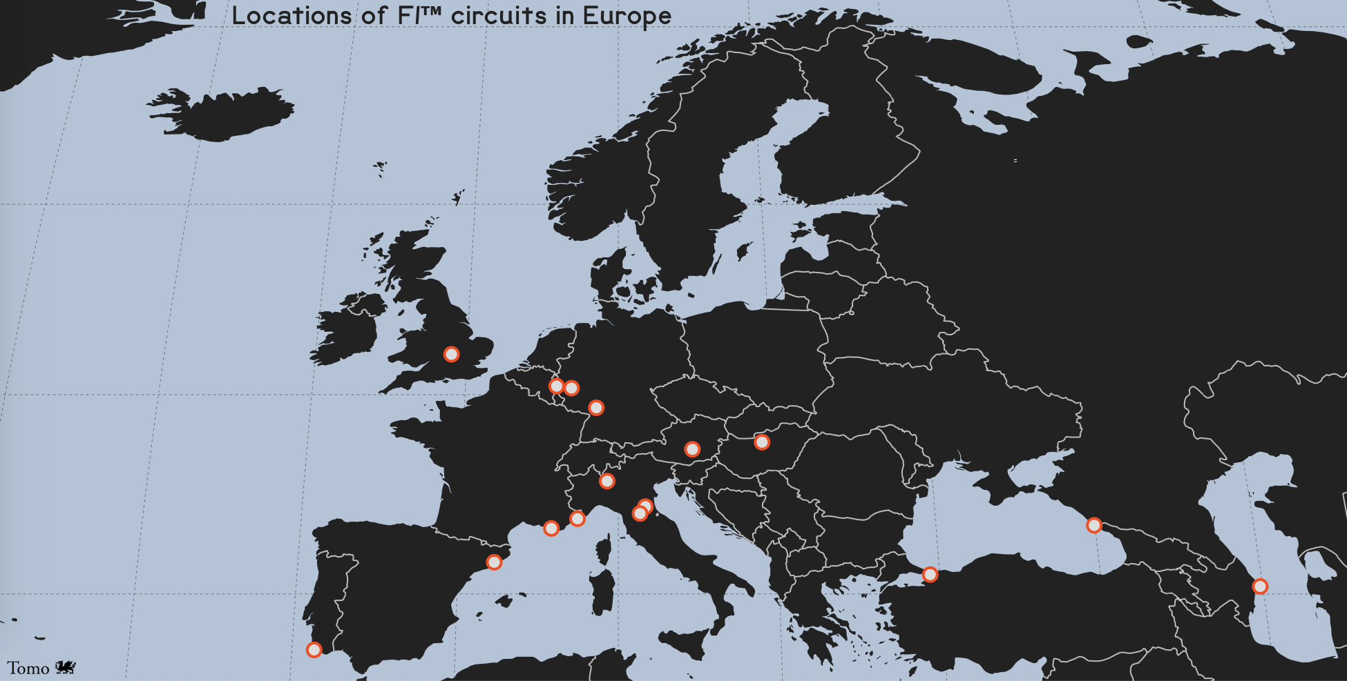
Day 2 of #30DayMapChallenge : Lines
Four distinctive but very recognizable F1™ track (out)lines
 Made with QGIS.
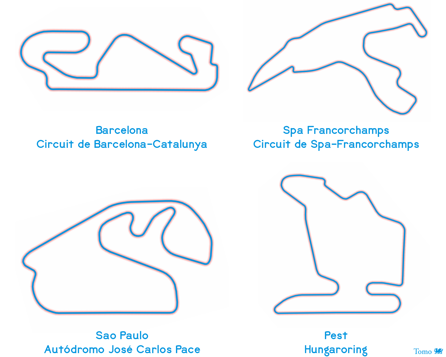
Day 3 of #30DayMapChallenge : Polygons
Monza - Autodromo Nazionale Monza
 Made with Affinity Designer.
Day 4 of #30DayMapChallenge : Hexagons
Skipped.
Day 5 of #30DayMapChallenge : Blue
Sea Blue @ Monte Carlo - Circuit de Monaco
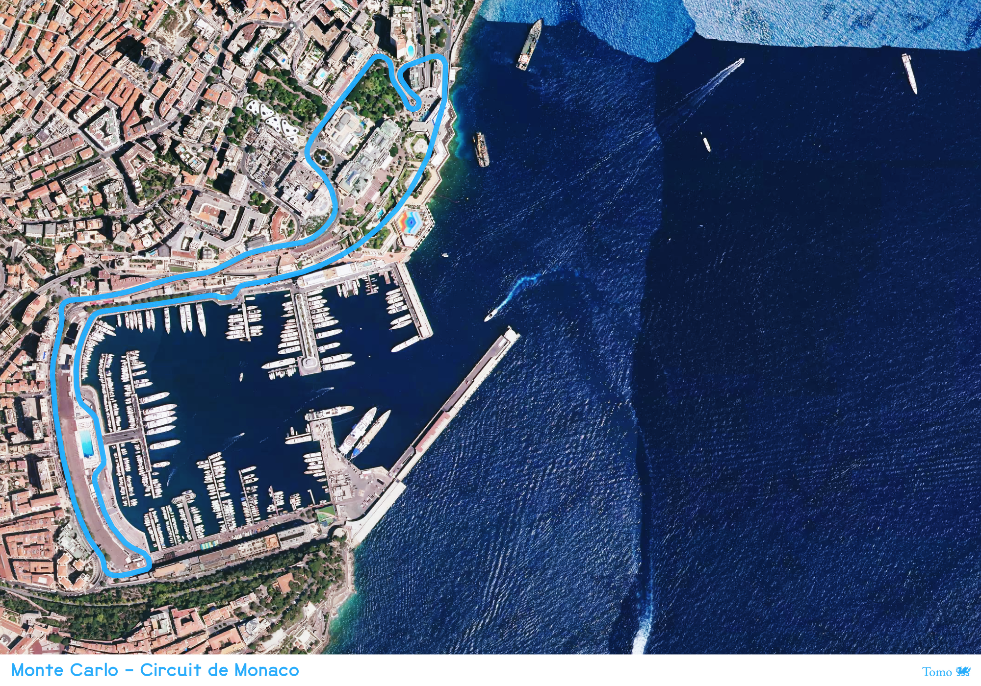 Made with Mapbox Satellite and Pixelmator Photo.
Day 6 of #30DayMapChallenge : Red
Ferrari Red @ Abu Dhabi - Yas Marina Circuit
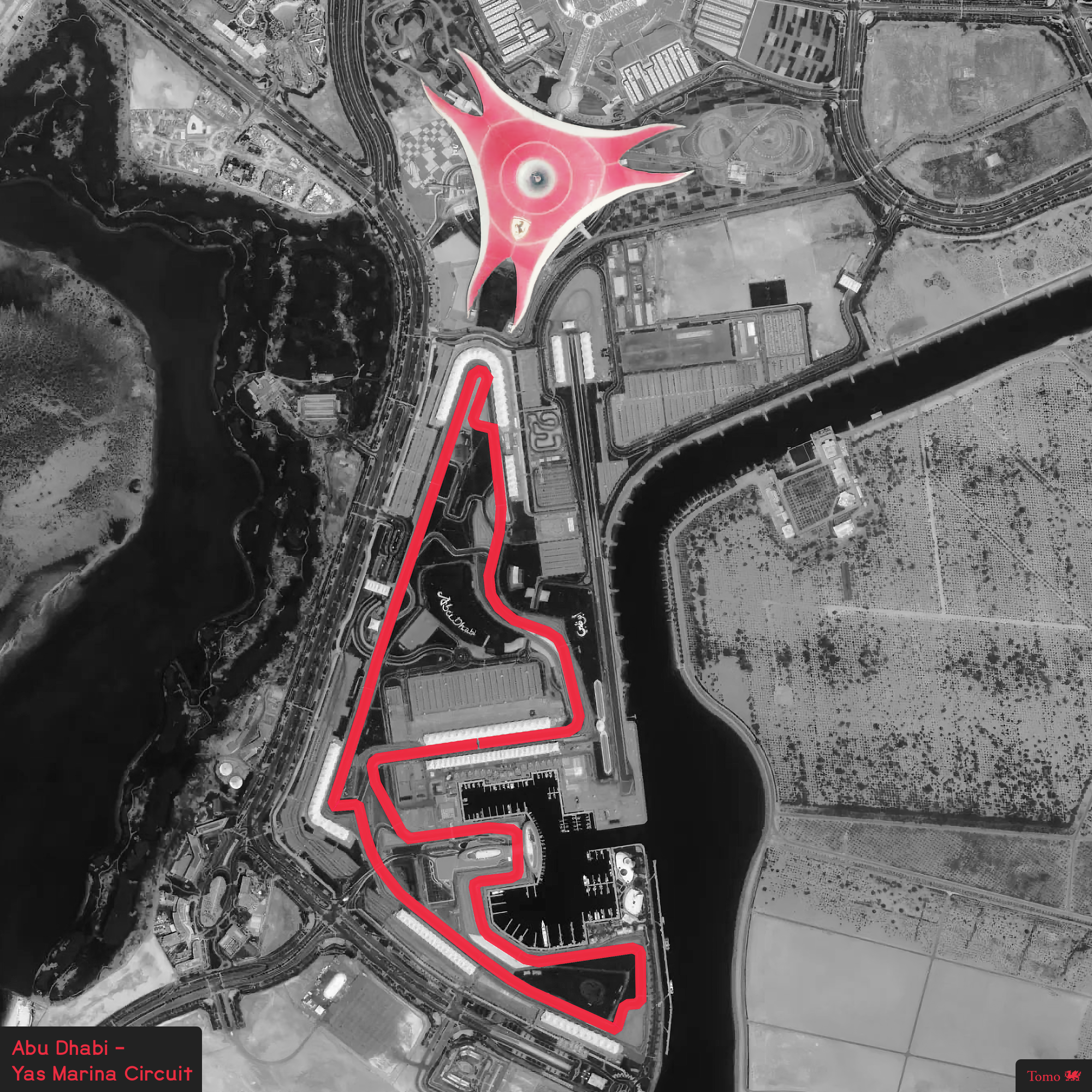 Made with Mapbox Satellite and Pixelmator Photo.
Day 7 of #30DayMapChallenge : Green
Forest Green @ Spielberg - Red Bull Ring
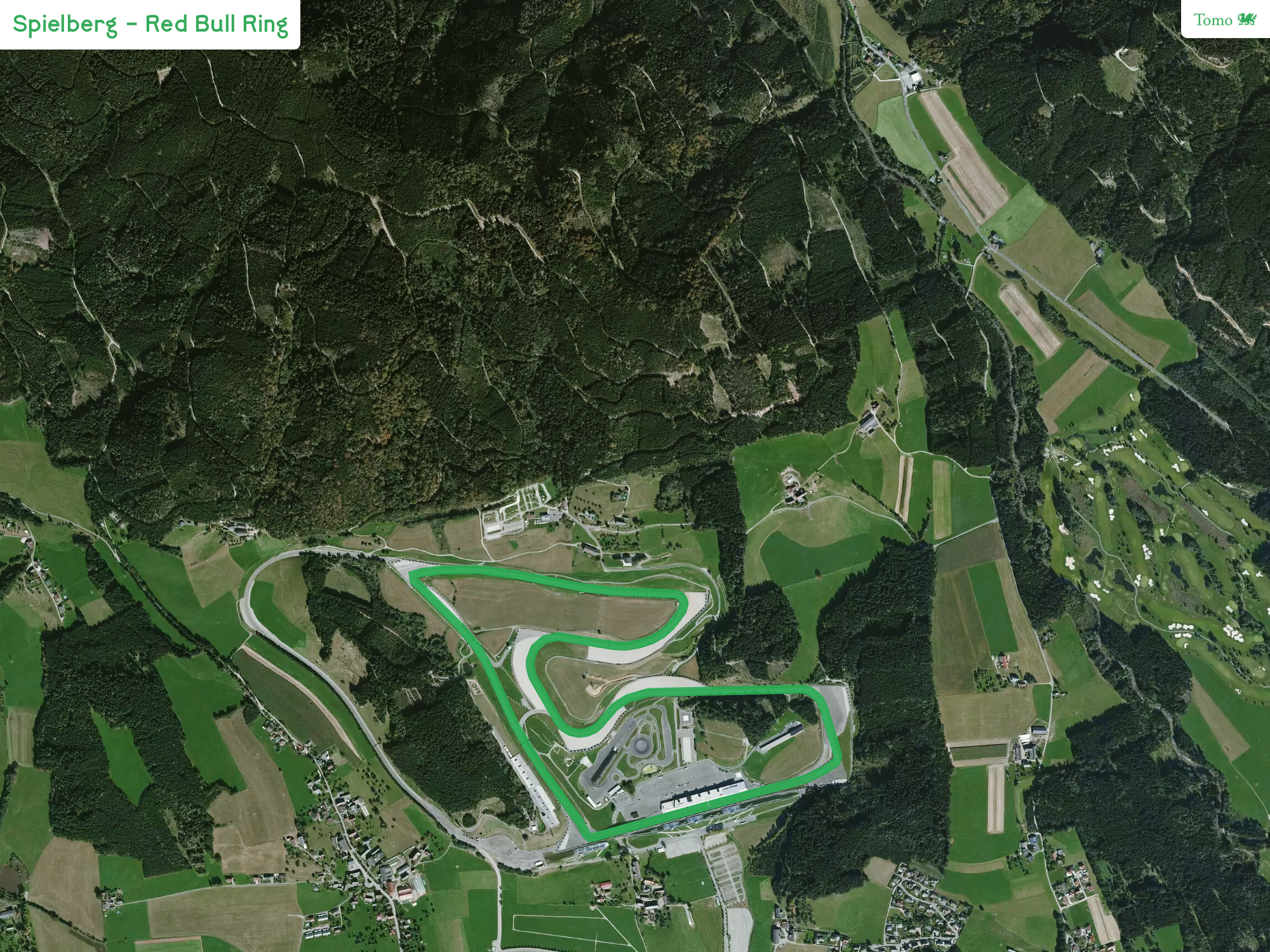 Made with Mapbox Satellite and Pixelmator Photo.
Day 8 of #30DayMapChallenge : Yellow
Desert Yellow @ Bahrain - Bahrain International Circuit
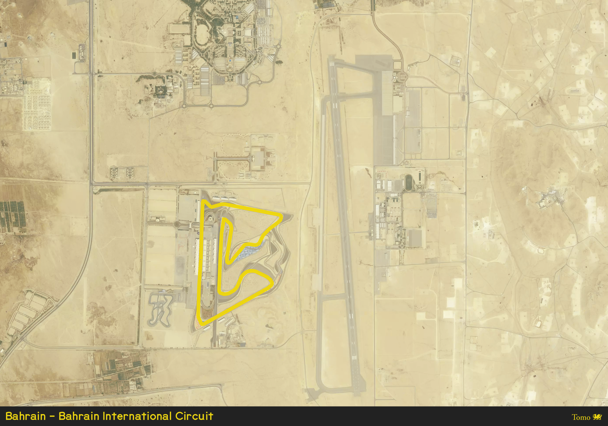 Made with Mapbox Satellite and Pixelmator Photo.
Day 9 of #30DayMapChallenge : Monochrome
F1™ circuits locations in the world
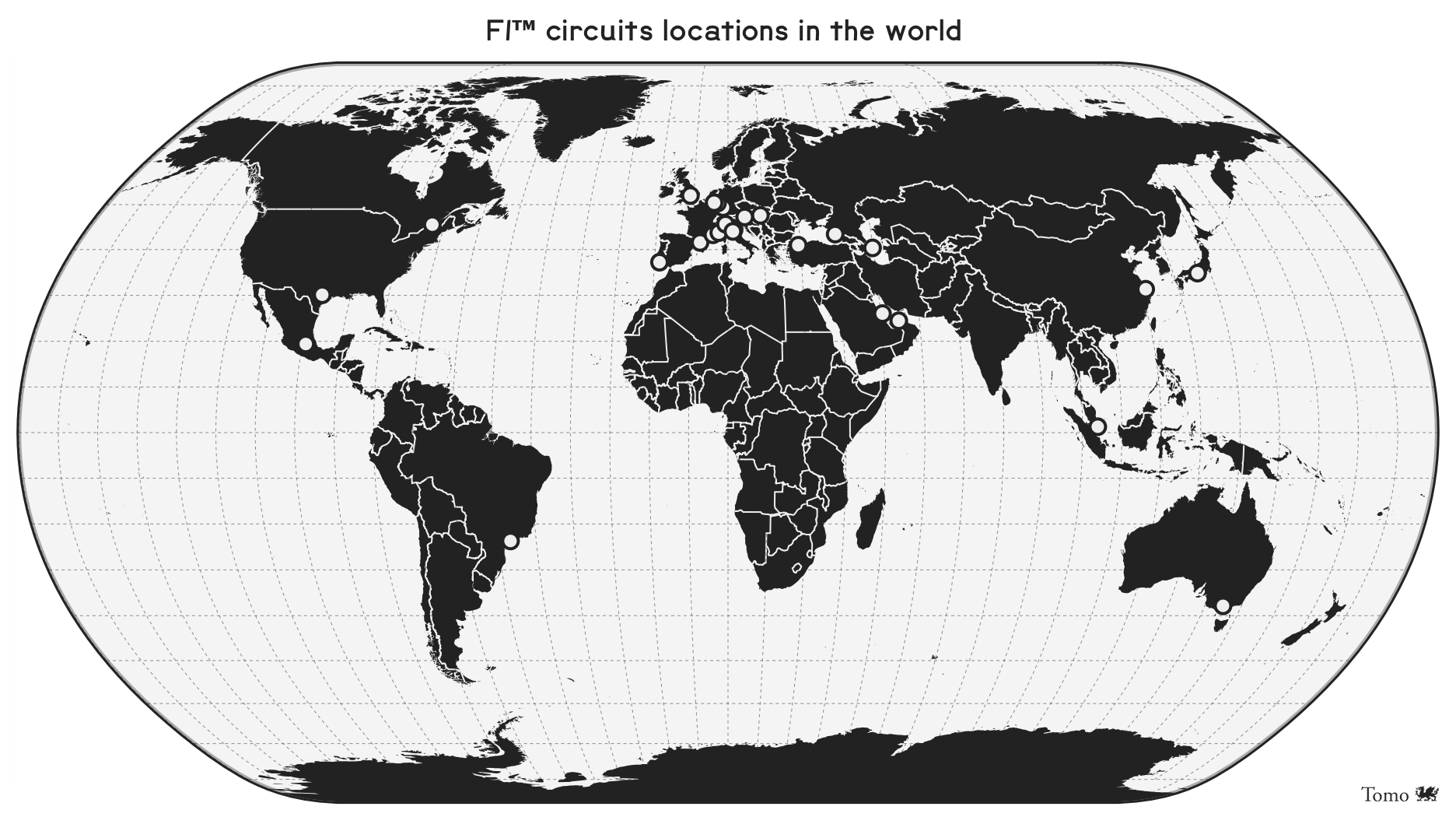 Made with D3js and Natural Earth map projection.
Day 10 of #30DayMapChallenge : Grid
World of F1™ circuits in Eisenlohr projection
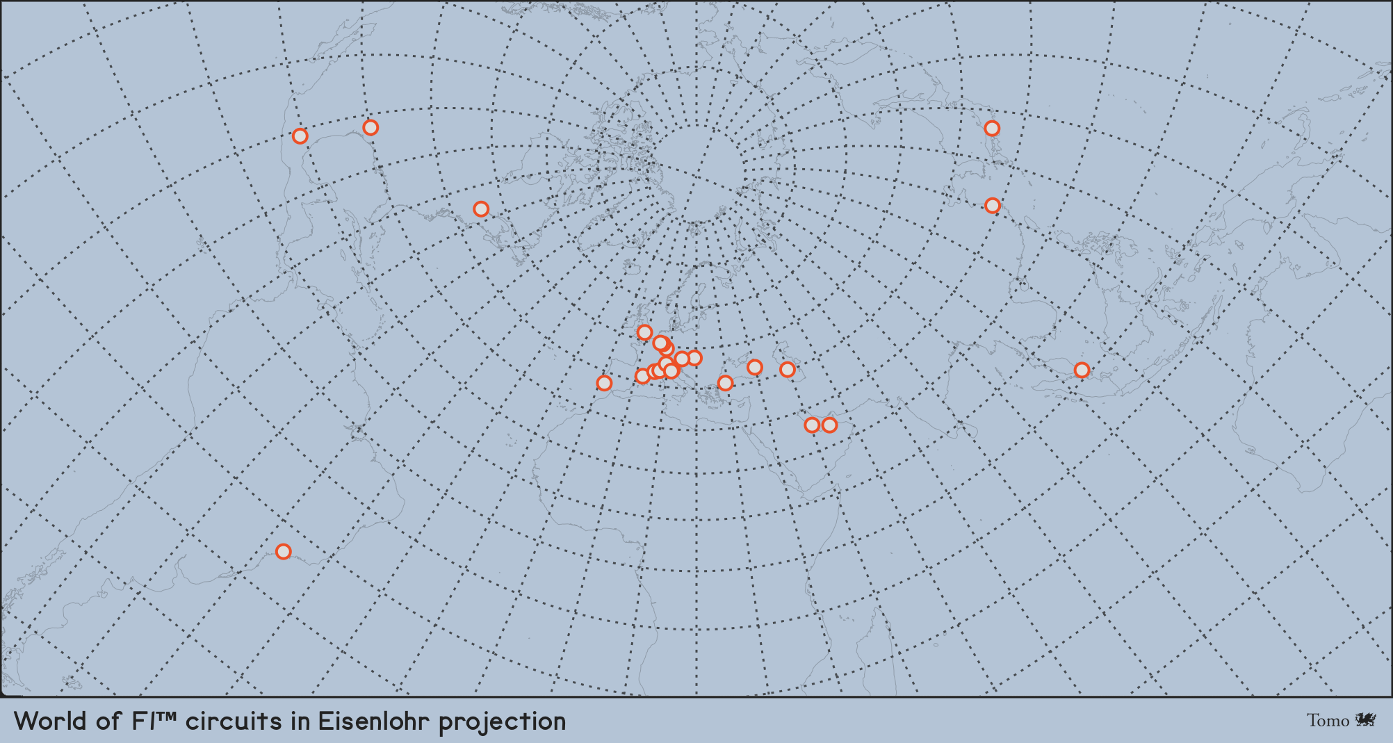 Europe has many circuits concentrated in a small area, making it challenging to create a good visualization. However, the focus is on the grid, so I emphasized the graticules and made the world contours light. Also, I played with projections to make the map more interesting. Made with D3js and Eisenlohr map projection.
Day 11 of #30DayMapChallenge : 3D
Altitudes of F1™ circuits in 3D
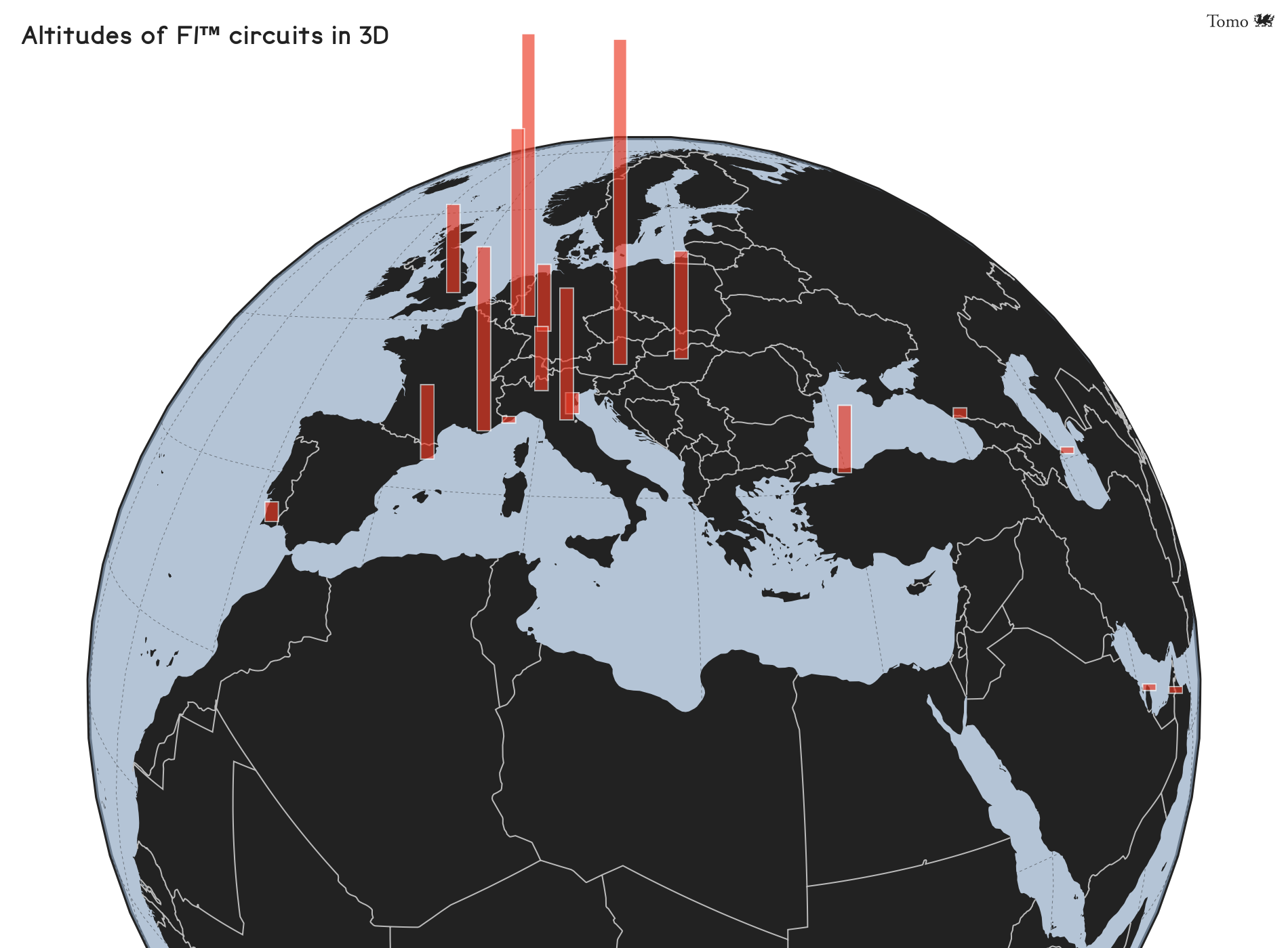 The bar height represents the circuit’s altitude above mean sea level. Made with D3js and ObservableHQ.
Day 12 of #30DayMapChallenge : Map not made with GIS software
Imola - Autodromo Enzo e Dino Ferrari
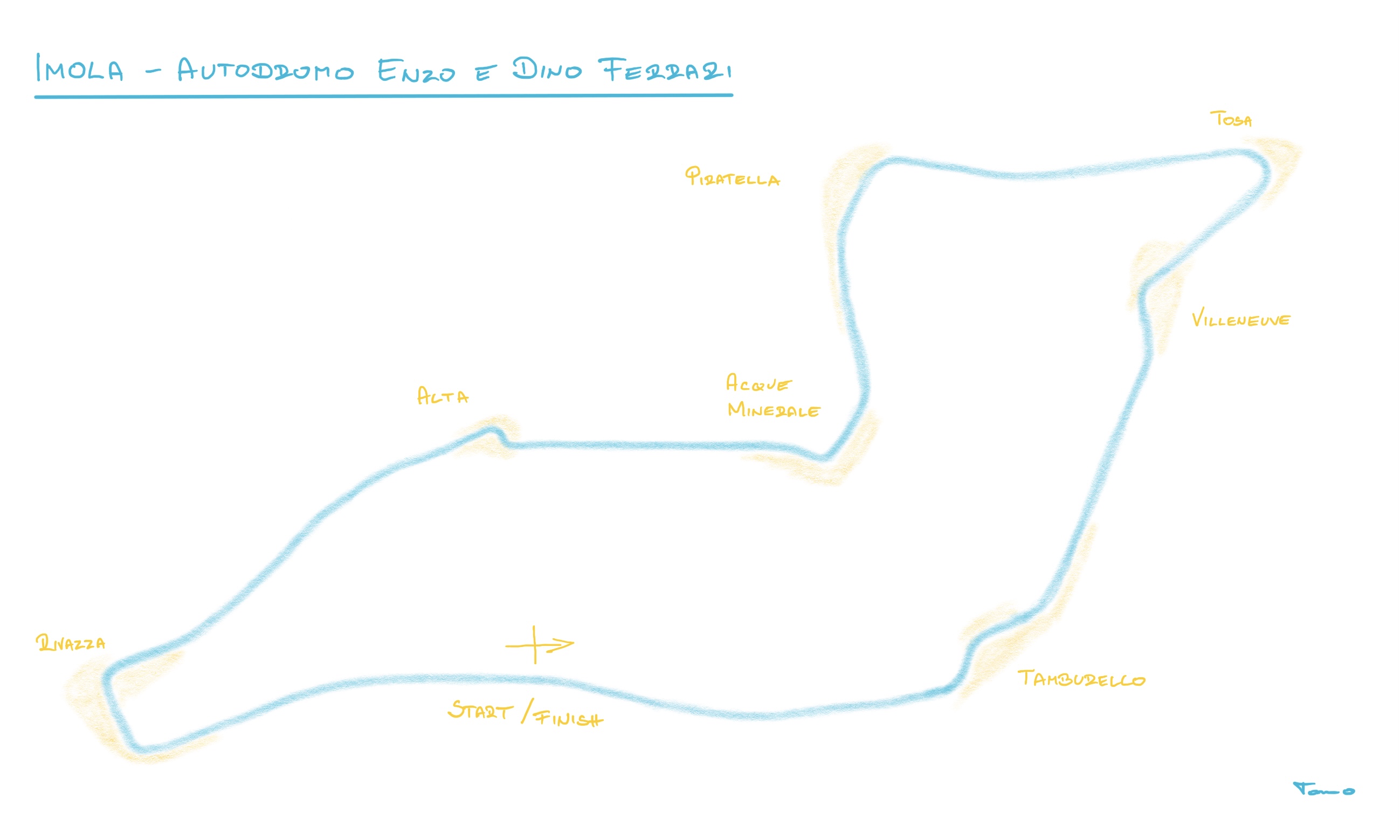 Hand-drawn map of Imola - Autodromo Enzo e Dino Ferrari circuit on iPad using Autodesk SketchBook and Apple Pencil.
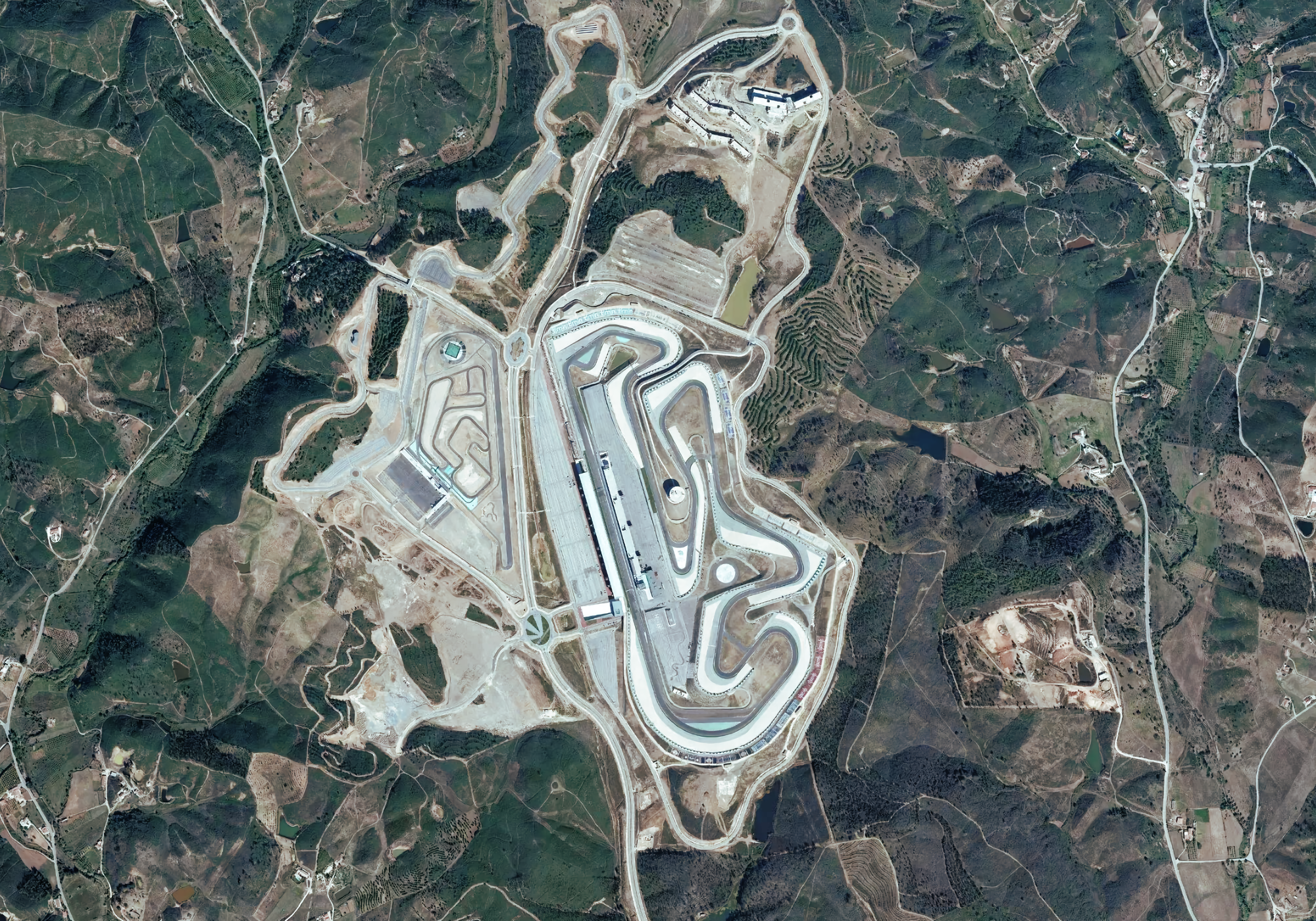
Day 13 of #30DayMapChallenge : Raster
Portimão - Autódromo Internacional do Algarve
 Sepang - Sepang International Circuit
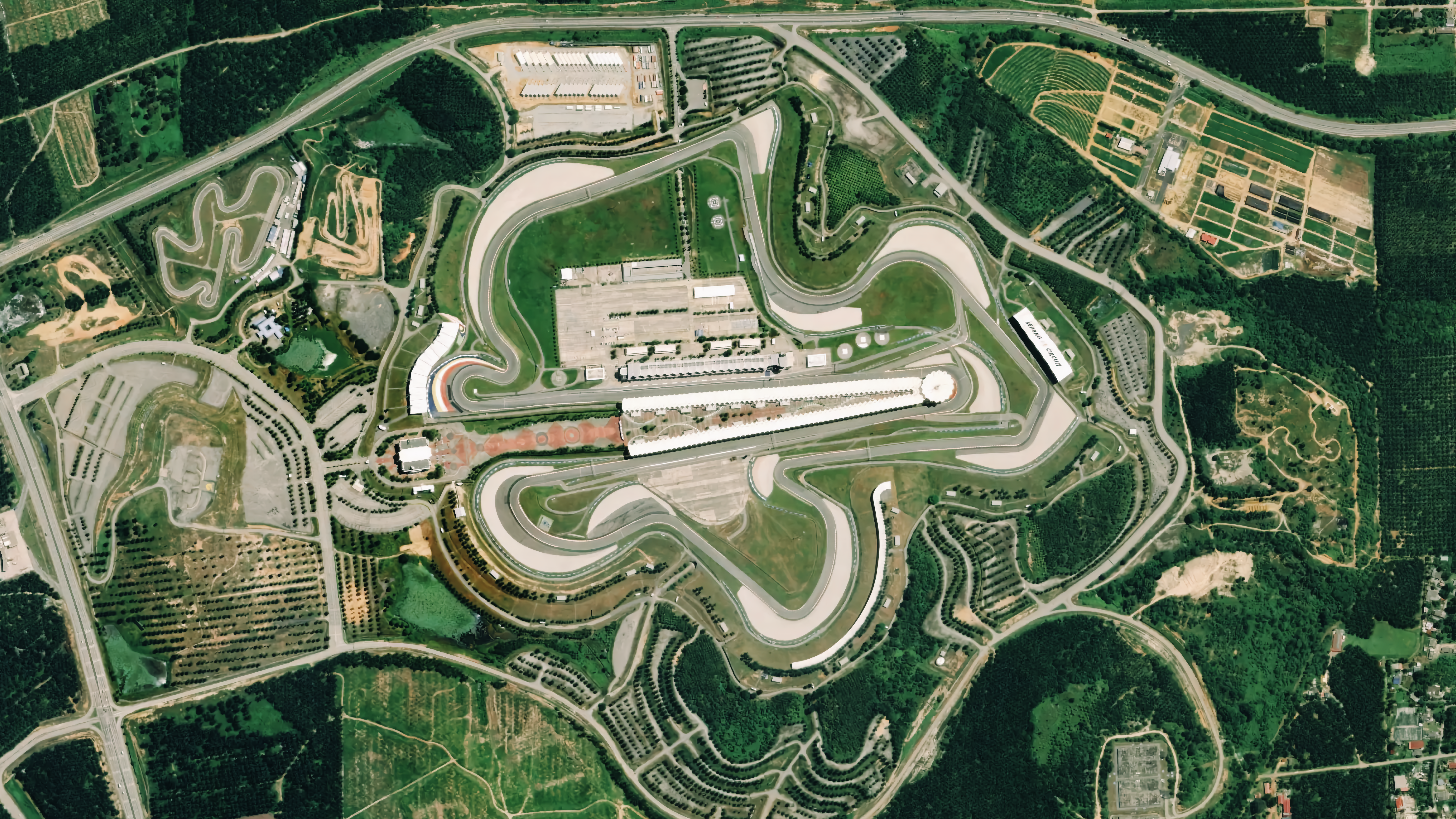 I posted two satellite images of F1™ circuits that are so clearly visible from space that no additional sketching or editing is needed.
Day 14 of #30DayMapChallenge : Climate change
Skipped.
Day 15 of #30DayMapChallenge : Connections
2019 F1™ World Championship
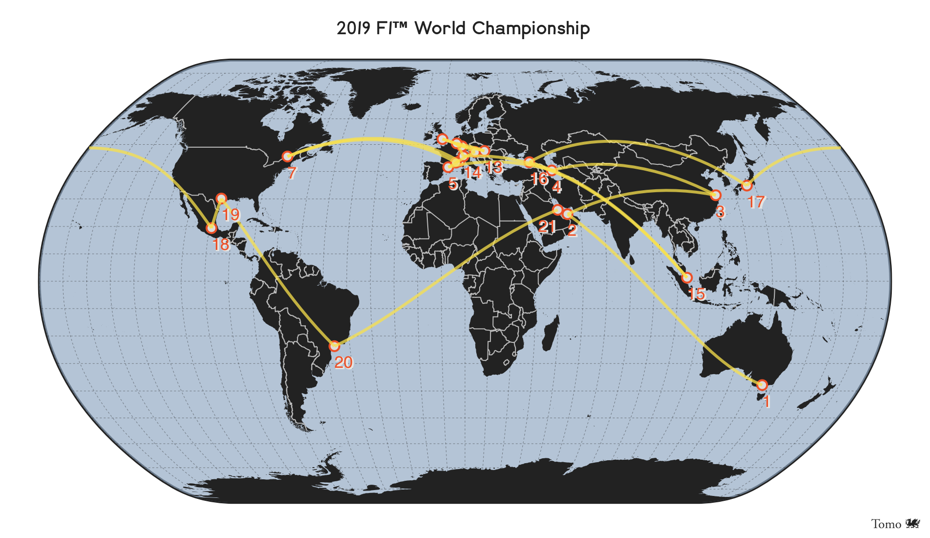 Lines represent travel connections between the 2019 World Championship circuits and the order in which the F1™ caravan traveled worldwide. It is evident how the F1™ calendar is inefficient and that there is much room for F1™ to be more environmental-friendly. Made with D3js and ObservableHQ.
Day 16 of #30DayMapChallenge : Island(s)
Montreal - Circuit Gilles-Villeneuve
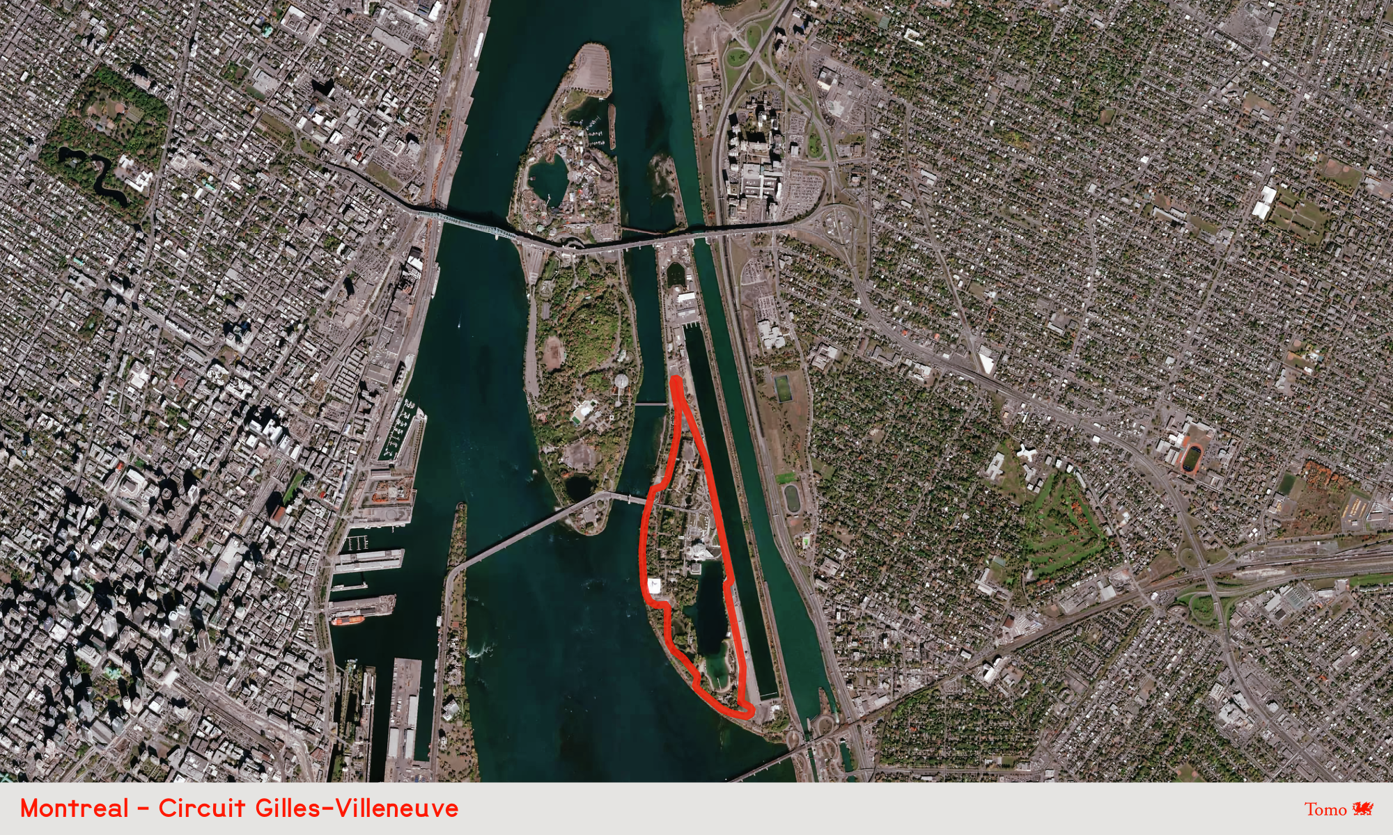 The Circuit Gilles-Villeneuve in Montreal is located on Notre Dame Island, a human-made island in the St. Lawrence River, most of which was initially built for the Expo in 1967. Made with Mapbox Satellite and Pixelmator Photo.
Day 17 of #30DayMapChallenge : Historical map
History of F1™ circuits by the year when they were built and opened
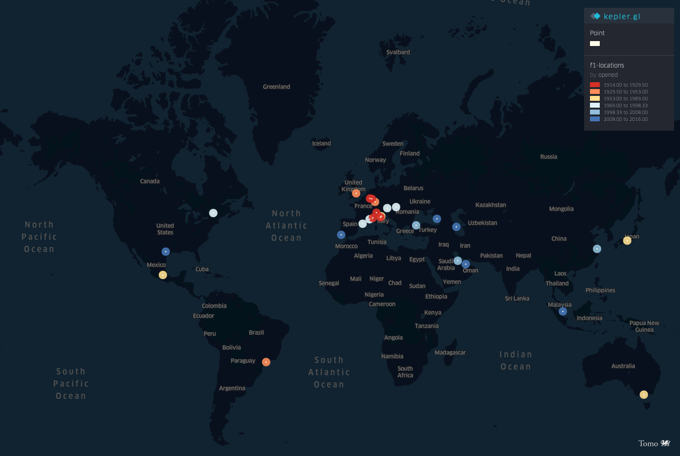 I used KeplerGL here. I am not fully satisfied with the map and how it turned out, but the KeplerGL is way too easy to use, and making this map, takes only a few clicks.
Day 18 of #30DayMapChallenge : Landuse
Silverstone - Silverstone Circuit
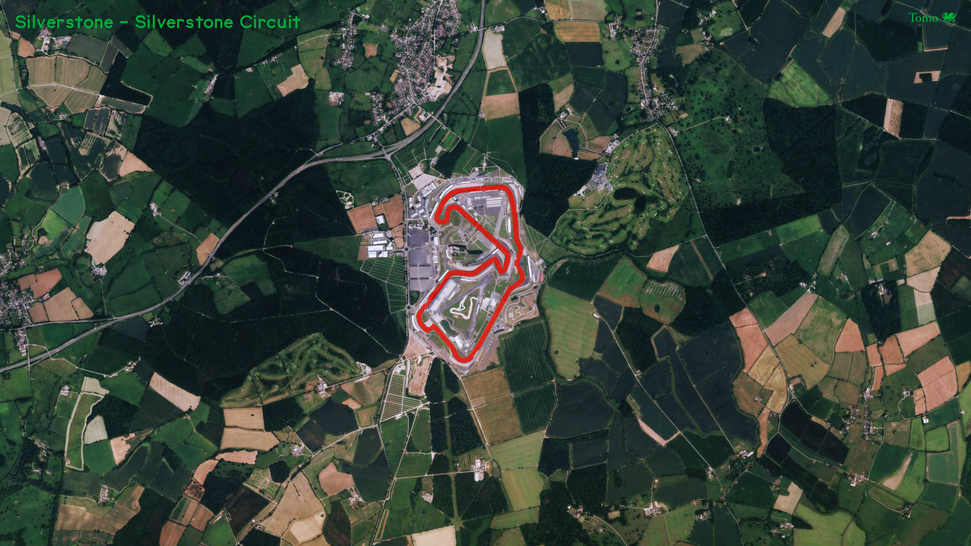 The Silverstone circuit is placed on a World War II Royal Air Force bomber station, RAF Silverstone. It is located near the Northamptonshire villages and surrounded by fields and forests. Made with Mapbox Satellite and Pixelmator Photo.
Day 19 of #30DayMapChallenge : NULL
Hockenheim - Hockenheimring
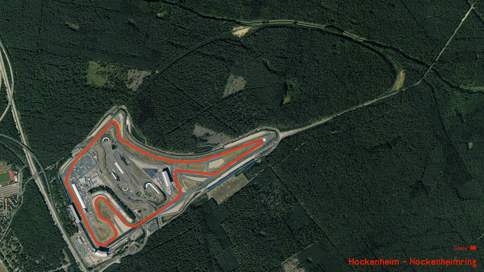 Hockenheimring used to have a very long section (1.3 km) going through forests. In 2002, the circuit was dramatically shortened, with the forested straights section chopped off. On the satellite image, it is visible the NULL part of the track. Made with Mapbox Satellite and Pixelmator Photo.
Day 20 of #30DayMapChallenge : Population
Mexico City - Autódromo Hermanos Rodríguez
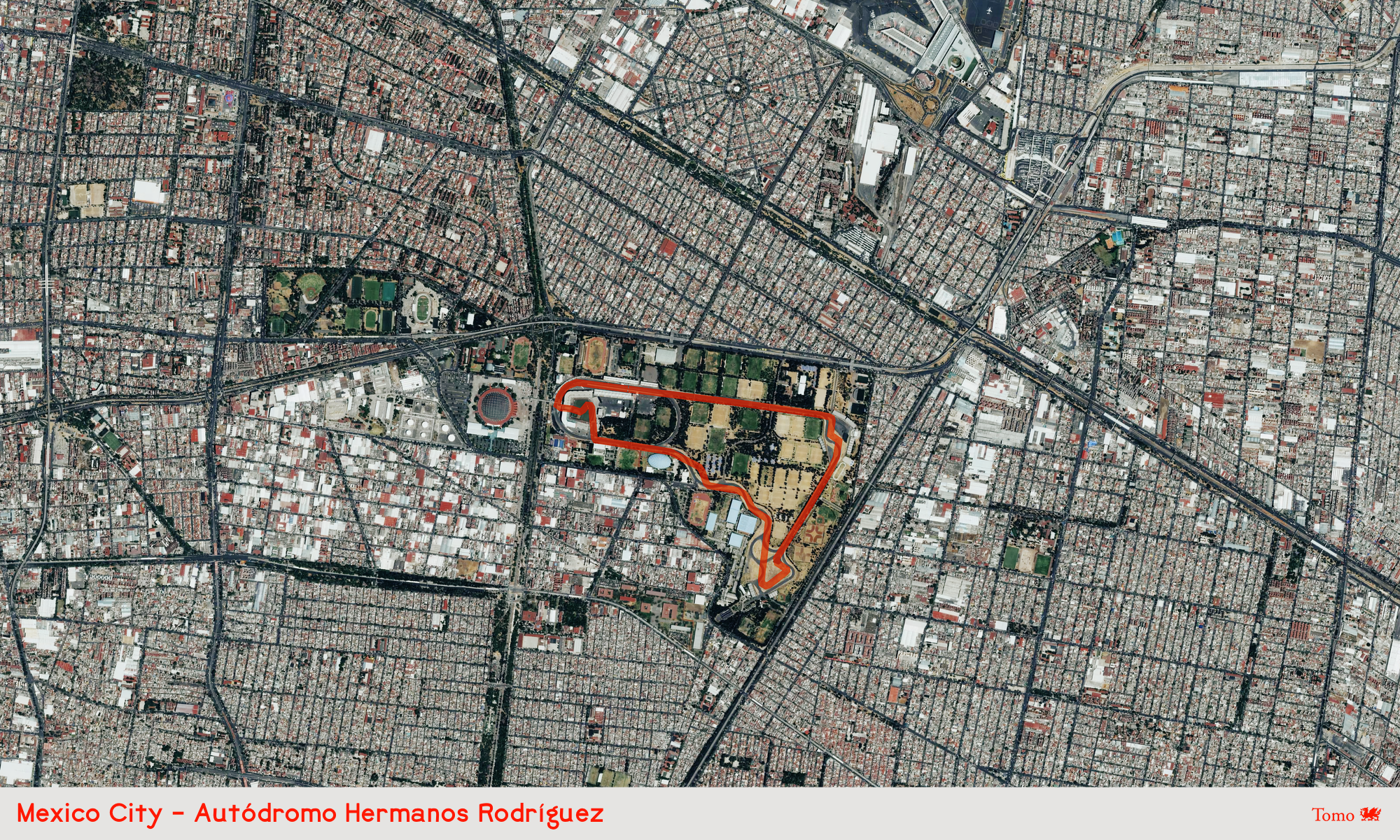 The Autódromo Hermanos Rodríguez circuit is built using the existing internal roads in Mexico City’s Magdalena Mixiuhca sports park. Mexico City is the fifth-largest city in the world. Made with Mapbox Satellite and Pixelmator Photo.
Day 21 of #30DayMapChallenge : Water
Melbourne - Albert Park Circuit
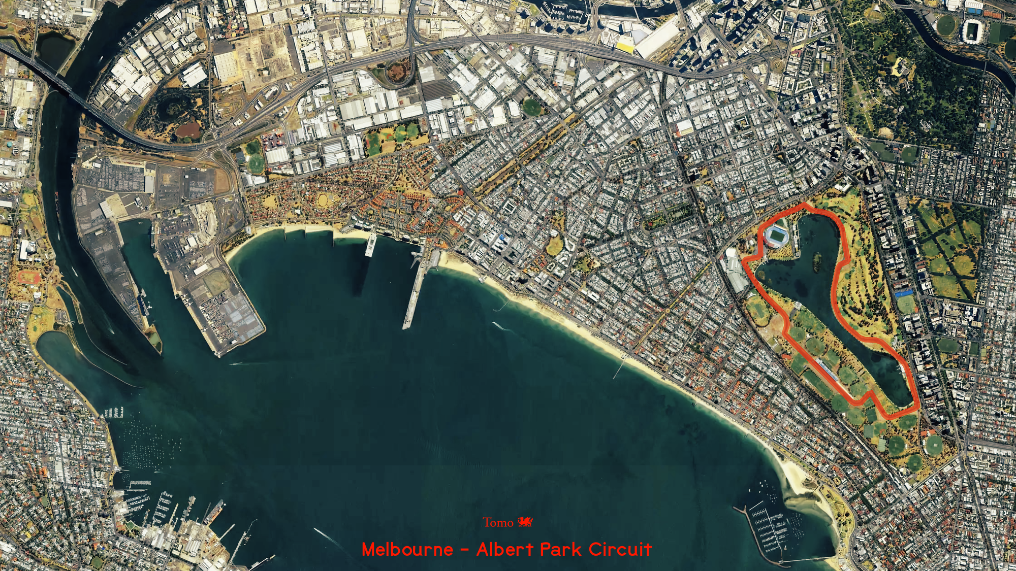 The Albert Park Circuit uses everyday road sections around Albert Park Lake in Melbourne. Each year, all the F1 infrastructure is erected two months before the GP weekend, and for the rest of the year, ordinary vehicles can use the track. Made with Mapbox Satellite and Pixelmator Photo.
Day 22 of #30DayMapChallenge : Movement
2019 F1™ World Championship Animated
Lines represent travel connections between the 2019 World Championship circuits, and the animation shows how the F1™ caravan traveled worldwide. It is evident how the F1™ calendar is inefficient and that there is much room for F1™ to be more environmental-friendly. Made with D3js and ObservableHQ.
Day 23 of #30DayMapChallenge : Boundaries
Skipped.
Day 24 of #30DayMapChallenge : Elevation
World of F1™ circuit altitudes in Stereographic projection
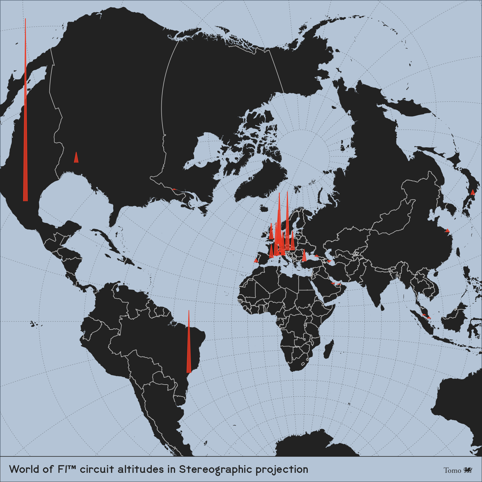 F1™ circuit elevations range from sea levels to 2232 meters. I picked the Stereographic projection to compare them all in one view and better understand how incredibly high Mexico City is. Made with D3js and ObservableHQ.
Day 25 of #30DayMapChallenge : COVID-19
2020 F1™ World Championship due to COVID-19
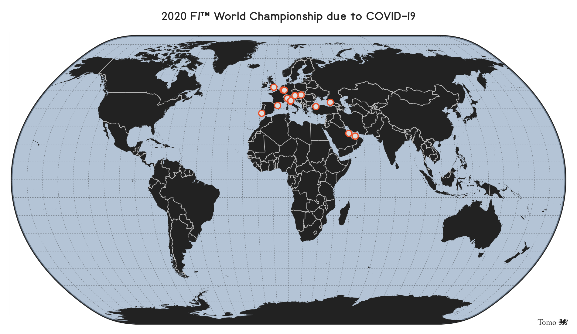 COVID-19 affected F1™ in 2020 pretty heavily, like all other professional sports and the world. However, F1™ managed to scramble enough track races holding GP weekends without spectators, and they were closely grouped mostly around Europe to ease the transportation and logistics nightmares. Made with D3js.
Day 26 of #30DayMapChallenge : Map with a new tool
History of F1™ circuits in Europe
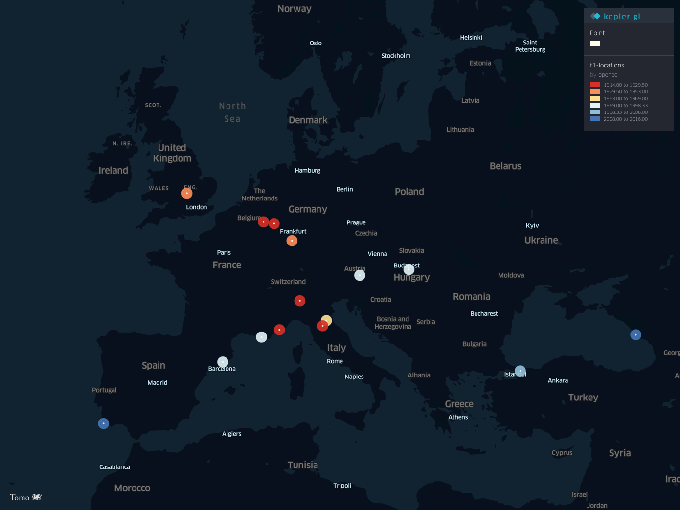 On day 17, I used a new tool, KeplerGL. Here is a map with that same tool and data, focused on the age of F1™ circuits in Europe. The map shows where the racing was born and how it spread to other worlds.
Day 27 of #30DayMapChallenge : Big or small data
Suzuka - Suzuka International Racing Course
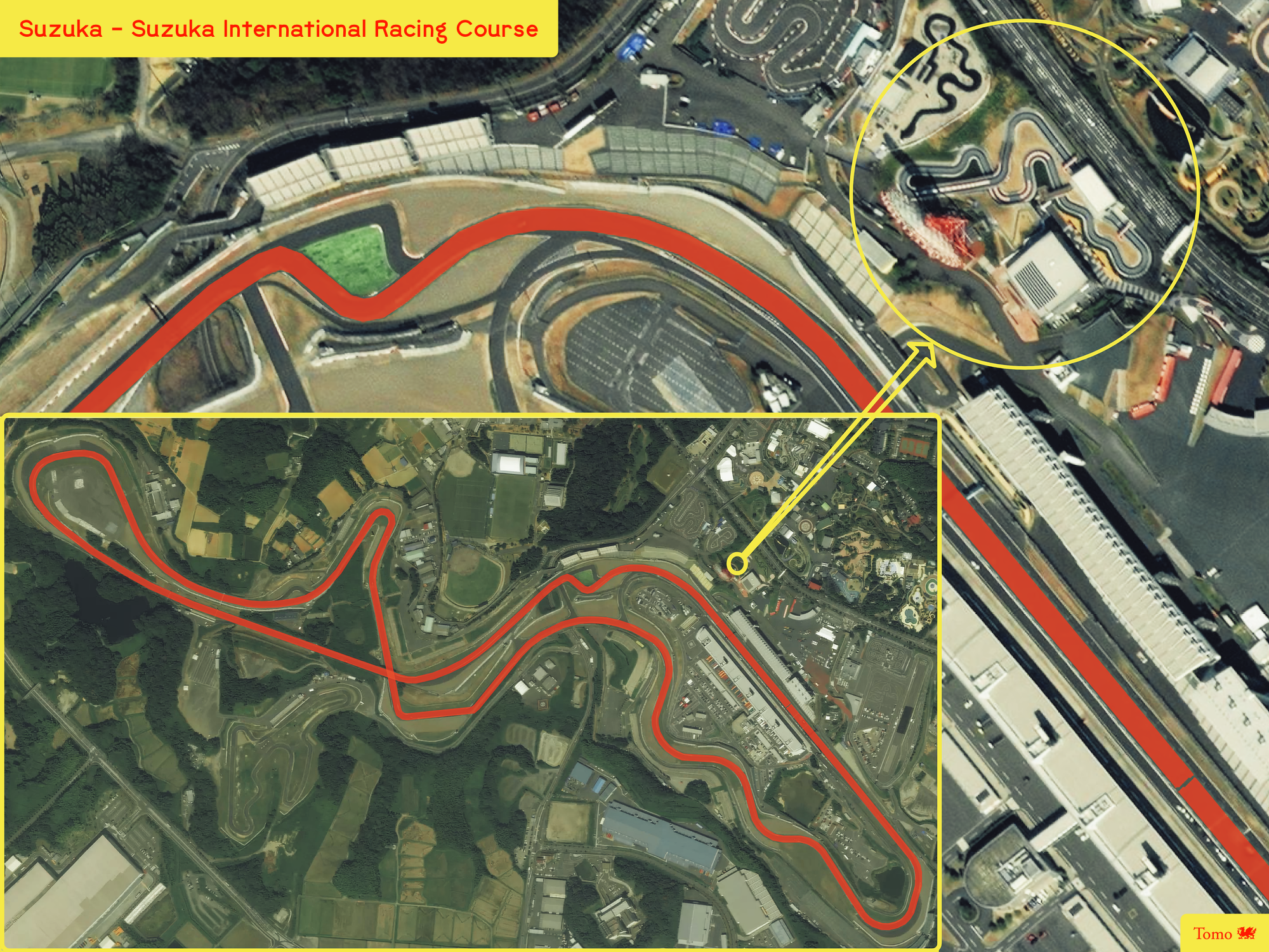 Nearby each F1™ circuit, there is always a tiny go-kart track. However, at Suzuka International Racing Course, the smaller version has precisely the same outline as the bigger sibling.
Day 28 of #30DayMapChallenge : Non-geographic map
Skipped
Day 29 of #30DayMapChallenge : Globe
World of F1™ circuits in Orthographic projection
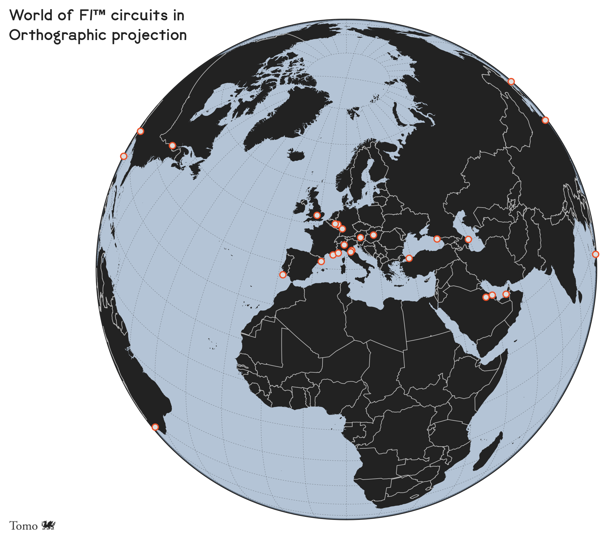 Made with D3js and ObservableHQ.
Day 30 of #30DayMapChallenge : A map
A repository of Formula 1™ circuits
For the challenge’s last day, I linked my interactive map accompanying the F1™ circuits repository. You can explore all the F1™ locations I showcased in my raster-based maps and more.
Summary
I produced 25 different maps and skipped only four days. The reason for missing these four days was primarily the lack of ideas on covering particular topics.
In the end, while it was a bit exhausting, I was satisfied with my work and had a lot of fun. My only hope is that others enjoyed my maps as much as I was creating them and that I shared some interesting facts on the way, plus introduced the world of F1™ circuits to a broader audience.
My work does not stop here. I might not be producing as many maps soon (maybe I should), but I will continue adding more circuits to my Formula 1™ repository. You are more than welcome to join me in the effort.