Hic Sunt Dracones
Trap Streets: Why Maps Contain Fake Streets and Towns
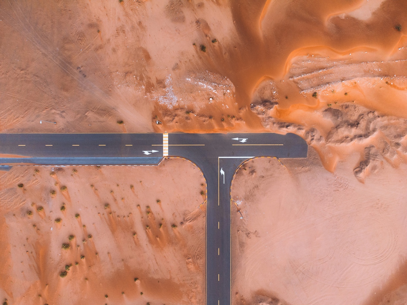 Photo by Peter Orsel on Unsplash
Mapmakers sometimes intentionally lie. They add fake details to their maps, but only in small details and for a surprisingly good reason. For about a hundred years, cartographers have included made-up streets and towns, called trap streets and paper towns, to catch competitors who copy their maps rather than conduct their own surveys. This article explains how that trick works, how a fake town became real, and how the same idea now catches AI models by hiding copyright traps in text.
What Is a Trap Street?
A trap street, also called a phantom street, is a fictitious street, or a deliberately distorted real one, that a mapmaker plants to detect unauthorized copying. Because the street does not exist in the real world, it can only appear on a competitor’s map if that competitor copied the original rather than surveying independently. Fake settlements used the same way are called paper towns or phantom settlements. Together they form the cartographic branch of a larger family of copyright traps, alongside fake dictionary words and invented encyclopedia entries.
Why Do Mapmakers Put Fake Streets on Maps?
Surveying costs a lot of money, but copying is much cheaper. That asymmetry has existed since mapmaking became a business, and it makes copying tempting: why send people out to survey when you can copy someone else’s map? The challenge for honest mapmakers is proving that someone stole their work, since accurate maps of the same place will naturally look very similar.
The answer was to add something that isn’t real. Reference book publishers discovered this trick early on. For example, the 1903 Music Lover’s Encyclopedia included the word “zzxjoanw” and said it was a Māori drum. It isn’t a Māori drum, and it isn’t even a real word. This fake entry stayed in print for about seventy years. Lexicographers now call these fake entries Mountweazels, named after Lillian Virginia Mountweazel, a made-up fountain designer and photographer created for the 1975 New Columbia Encyclopedia and reported to have died in an explosion while on assignment for Combustibles magazine.
Cartographers used the same trick in their maps by adding a fake alley, an invented curve in a road, or a made-up village at a quiet intersection. If those made-up features appear on a competitor’s map, you have your evidence.
Did a Fake Town Really Become Real?
Yes, and it is one of the most interesting stories in cartography. Nearly a century ago, Otto G. Lindberg of the General Drafting Company and his assistant Ernest Alpers placed a fictional hamlet at a dirt-road junction in the Catskills on their map of New York State. They named it Agloe, an anagram of their combined initials.
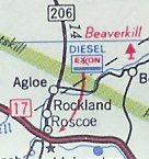
Years later, Agloe appeared on a Rand McNally map. Was this proof of copying? Not exactly. Rand McNally argued that Agloe had become a real place. People saw the name on gas-station maps and started using it, first for a fishing lodge and then for the Agloe General Store at the same spot. The trap even made it into county records. The store is now gone, but Agloe remained on paper maps for years, appeared on Google Maps until 2014, and inspired John Green’s novel Paper Towns. Fans still visit the place, which exists mostly because it was never supposed to.
Have Trap Streets Ever Caught a Copycat?
Sometimes. One of the best recent examples is Argleton, a fake village in Lancashire, England, that showed up on Google Maps around 2008. It even had job listings and property searches, but in reality, it was just an empty field. A university employee noticed it, people online investigated, and the “town” quietly disappeared from the map by 2010. The data likely came from a licensed third-party source, and the leading theory is that Argleton was a copyright trap that accidentally became public.
The largest settlement for map copying did not involve trap streets. In 2001, the UK’s Ordnance Survey reached a £20 million agreement with the Automobile Association over AA atlases and town plans that were based on OS maps. Ordnance Survey says it does not add fake details, since misleading users would not be acceptable for a national mapping agency. Instead, its experts found small stylistic “fingerprints,” such as the exact width of roads, that showed copying.
The clearest examples of catching copycats have happened outside of mapmaking. In 2001, the New Oxford American Dictionary added the fake word “esquivalience,” meaning to avoid one’s official duties. Later, this word showed up on Dictionary.com, credited to a different dictionary. The entry was removed, proving the point. Ten years later, Google thought Bing was copying its search results, so Google created nonsense searches like “hiybbprqag” that led to unrelated pages. When Bing showed the same results, Google had proof of copying, but this time the trap was in hyperlinks.
Are Trap Streets Still Used Today?
Adding fake details to digital maps is becoming rare, mainly because satellite imagery, GPS data, and crowdsourced edits make it easy to spot and report fake streets quickly. Today, map providers use digital watermarking, licensing data, and unique data patterns instead. Some navigation data companies have set their own traps. For example, TeleAtlas, which supplied data for early Google Maps, is widely credited with including a fake Moat Lane in North London that stayed on Google Maps into the 2010s. It was revealed as fake only when satellite imagery showed trees and gardens instead of a street. OpenStreetMap takes a different approach and does not allow deliberate errors, saying its unique coverage and honest mistakes already make its maps easy to identify.
Printed maps are still the main place for trap streets. In 2005, the BBC show Map Man reported that the Geographers’ A-Z Map Company claimed the London A-Z had “about 100” trap streets. One example is Bartlett Place, a real walkway renamed after an employee, Kieran Bartlett. Later editions changed the name back to Broadway Walk. Older A-Z editions also showed a fake ski slope in London’s Haggerston Park, which confused the local park users so much that they discussed it at a meeting.
The A-Z map of Bristol includes a dead-end street called Lye Close off Canynge Square, but the street doesn’t exist. The name itself is a hint. Meanwhile, a driver’s atlas of Athens takes a different approach, printing a warning inside the front cover and telling anyone thinking of copying the map to watch out for trap streets.
Can a Trap Street Catch an AI?
In a way, yes, and this is where the idea gets its second life. In 2024, researchers at Imperial College London suggested adding unique, made-up sentences to articles or books as copyright traps for large language models. This lets content owners later check whether an AI model was trained on their text. Lead researcher Yves-Alexandre de Montjoye said the idea was inspired by the fake towns that early twentieth-century mapmakers made up. Now, a century after Agloe, the trap street has become a sentence, and the fight has moved from printed maps to AI training data.
For anyone who works with data, this lesson remains important today. Reference data always has a signature, whether it was added on purpose or by accident, and anyone who copies the data copies that signature. Cartographers just figured this out before everyone else did.
FAQ
Is Agloe, New York a real place?
No. Agloe was invented as a copyright trap about a century ago, briefly “became real” when local businesses adopted the name, and today is an unmarked rural crossroads in the Catskills that map enthusiasts still visit.
What is the difference between a trap street and a paper street?
A trap street is a deliberate fiction planted to detect copying. A paper street was legally planned and platted but never built. Both appear on maps but don’t exist on the ground, but only the former is a trick.
Why are fake settlements called paper towns?
They are called paper towns because they exist only on maps, not in real life. In nineteenth-century America, a paper town was a settlement speculators planned and advertised but never actually built. This idea is similar to a legal paper street. Later, John Green’s novel Paper Towns connected the term to Agloe and the idea of a copyright trap, and that meaning became popular. When accuracy is important, cartographers use terms such as “trap street” or “phantom settlement” to clarify the purpose.
Does Google Maps have fake streets?
Google has never confirmed planting any. Phantom features that have appeared, such as Argleton, are generally attributed to errors or to traps inherited from licensed third-party data. Modern providers rely on watermarking and data fingerprinting instead.
Is the trap street in Doctor Who real?
No, but it is a real cartographic term. The 2015 episode “Face the Raven” borrowed the concept for a hidden London street sheltering alien refugees, and China Miéville’s novel Kraken imagined the London A-Z’s trap streets as refuges for the city’s magical underground. Real trap streets are considerably less inhabited.