Hic Sunt Dracones
Mapping the Formula 1™ Las Vegas Grand Prix
In March 2022, Formula 1™ announced the Las Vegas Grand Prix. I knew I had to add this new spectacular street circuit to my open-source repository of Formula 1 tracks. The challenge? Creating an accurate digital map of a city racetrack that isn’t built yet.
Racing Down the Strip
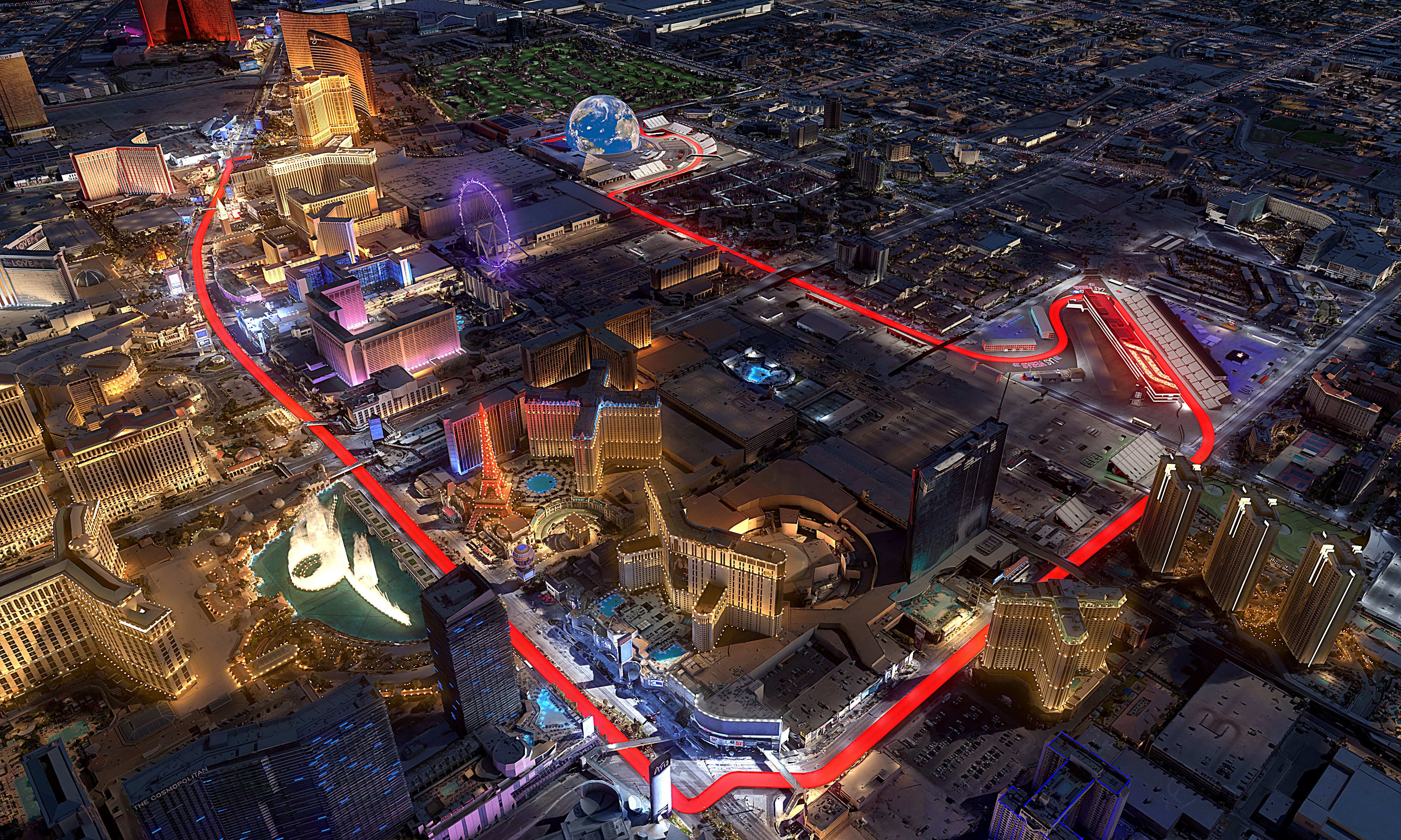
The Las Vegas Grand Prix promises to be unlike any other race on the calendar. Picture this: Formula 1 cars screaming past the Bellagio fountains at 354 km/h (220 mph). Their engines echoing off casino walls as they race under the neon lights of the Strip. This new circuit isn’t merely another race—it’s Vegas putting on a show.
The new 6.201 km (3.853 miles) circuit features 17 turns. What makes it special is the jaw-dropping 1.920 km (1.193 miles) straight. It runs right through the heart of the Las Vegas Strip, where drivers will hit those incredible top speeds.
From Parking Lot to Paddock
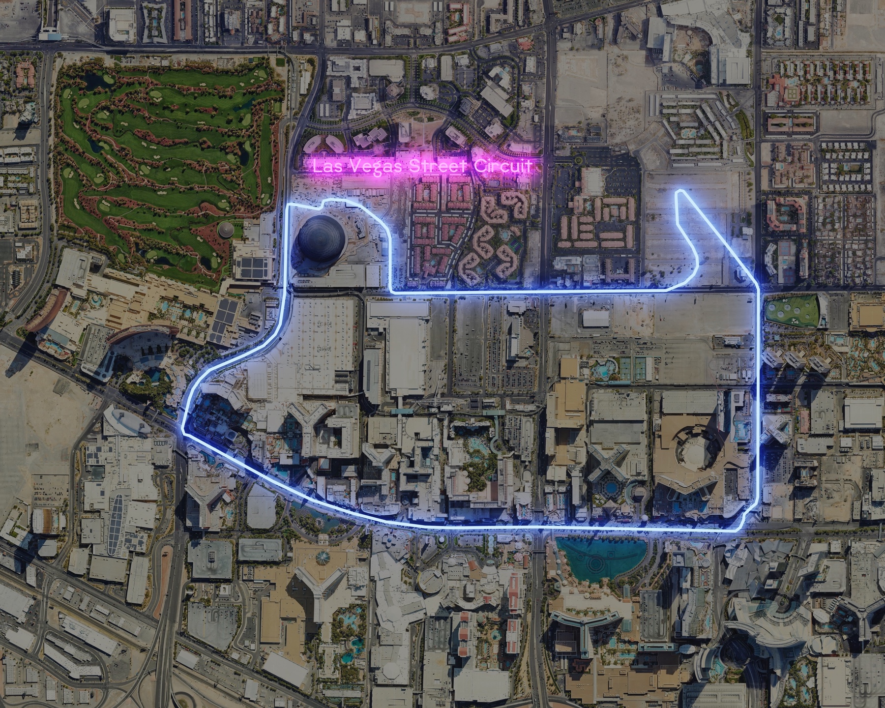
The most intriguing part of this circuit is its hybrid nature. Unlike temporary street circuits such as Monaco, Las Vegas is building a permanent facility within an old parking lot, complete with a proper pit complex and paddock area. The rest of the track repurposes existing city streets, weaving past iconic landmarks like the new MSG Sphere arena.
The Digital Detective Work
Here’s where it gets interesting: How do you map a racetrack that doesn’t exist yet?
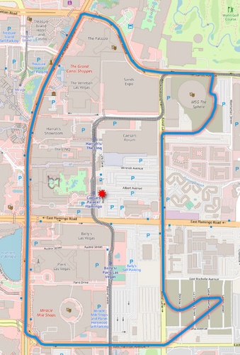
Thanks to dedicated Wikipedia contributors who had meticulously documented the proposed route, I was able to piece together the circuit layout like a digital jigsaw puzzle. Using their detailed descriptions, satellite imagery, and official announcements, I reconstructed the track turn by turn. I created a precise vector GeoJSON version of the track that developers and racing fans can use in their projects.
Evolution of the Track
Creating digital maps of future infrastructure is never a one-and-done process. In August 2025, as new satellite images became available and with the help of awesome contributors, we got an updated layout with several crucial corrections:
- Start/Finish Complex: Aligned with the actual pit building and grandstand locations.
- The Palazzo Corner: Fixed the intersection geometry to show the 90-degree turn onto Las Vegas Boulevard.
- Boulevard Alignment: Corrected the circuit to follow the western (southbound) lanes of Las Vegas Boulevard.
- Sphere Section: Refined the track layout around the MSG Sphere based on as-built conditions.
Why This Matters
Open-source geographic data might sound niche. But now, thanks to community collaboration and open data, we have a digital blueprint of this ambitious project that anyone can use and improve.
Want to use this data or contribute to the project? Check out my Formula 1 circuits repository on GitHub, where you’ll find GeoJSON files for every track on the calendar—past and present.
🛒 Purchase the Las Vegas Street Circuit Map Print Poster 🗺️