Hic Sunt Dracones
Gauss–Krüger to WGS84 Coordinates Transformation Tool
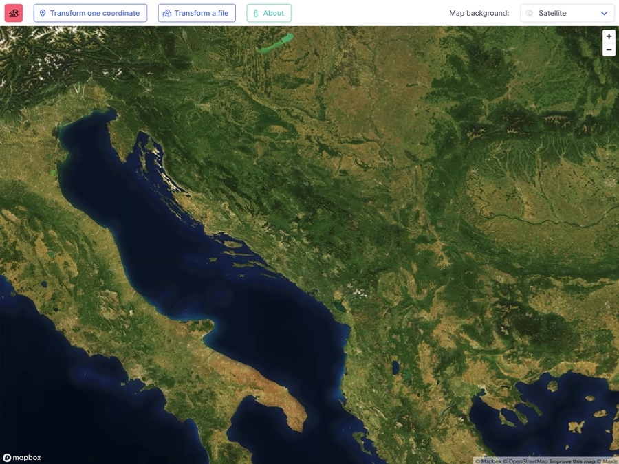
Gauss is a web-based application with an accompanying map for transforming coordinates between different coordinate systems used in the Balkans. The most common example is transforming GPS coordinates from WGS84 to a Gauss–Krüger projection and vice versa.
The supported coordinate systems are WGS84, HTRS96/TM, Gauss–Krüger zone 5, 6, and 7.
How to use the app
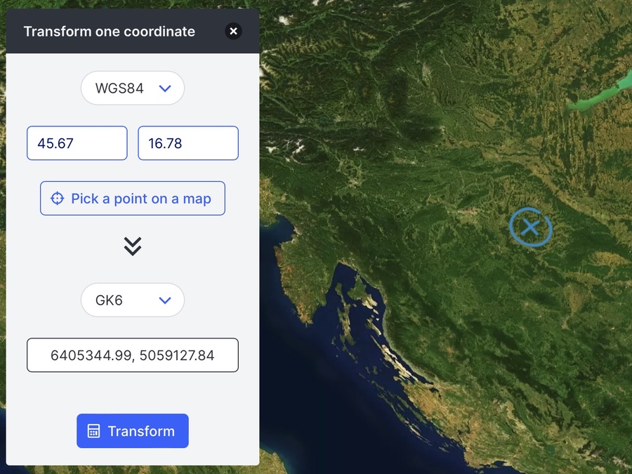
Gauss is designed with simplicity and user-friendliness in mind. Its straightforward interface allows you to transform one coordinate at a time or upload a file with multiple coordinates.
If you do not know the exact coordinates, you can pick a point on the map and transform it that way.
The application supports popular file formats like CSV and GPX. Once you execute the transformation, all your coordinates are shown on the map, and you can conveniently download the newly transformed coordinates in a CSV file. Gauss makes the complex task of coordinate transformation easy and accessible for all users.
Some things to keep in mind:
- The input coordinates need to use a decimal point.
- Coordinates in the CSV file must also use a decimal point, be separated by a comma, and have no other text or headers. Here is an example CSV file with coordinates in GK5.
- Select the input and output coordinate systems before uploading the file. Once you select a file, this action automatically triggers the transformations based on the chosen coordinate system settings.
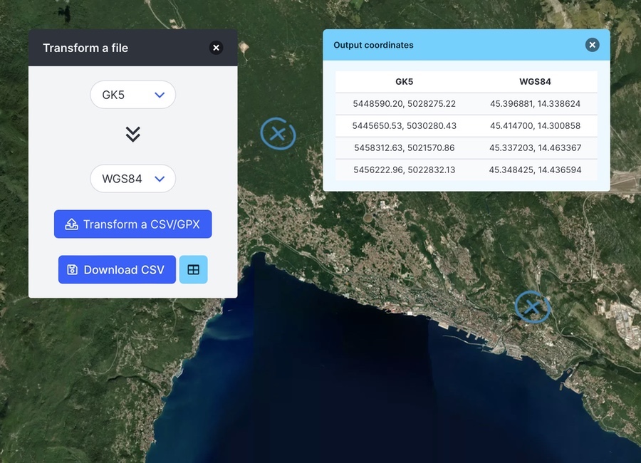
After transforming coordinates from your input file, you can hide the output table and zoom around the map to inspect the points closer. You can always return the table view by selecting the light-blue table button.
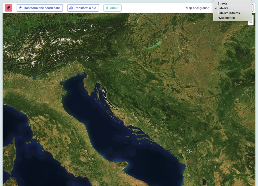
Suppose more than the satellite-only base map is required. In that case, there are options to change the map background and pick a different choice with more details and additional map features.
Privacy Policy
Gauss prioritizes your privacy and data security. It’s important to note that no data is collected, stored, or transmitted over the Internet. All data is kept temporarily in your local browser memory only. Gauss is a client-side application with no server-side scripts, ensuring your data remains secure and private. You can confidently use Gauss, knowing that your data is safe.
The application is written in pure Vanilla JavaScript. It relies on two external projects: Mapbox for cartography and open-source Proj4js for transformation calculations.
Feedback
This is a basic overview of the application. Your feedback is highly valued and can help shape the future of this tool. If you have any questions, comments, or concerns, please don’t hesitate to get in touch. I’m open to suggestions for new features that could enhance your daily workflow and improve your application experience.
Lastly, the application is free to use. If you find this application valuable and want to support it, consider buying a satellite imagery map poster from my Etsy shop.