Hic Sunt Dracones
F1 Jeddah Street Circuit in Vector GeoJSON Format
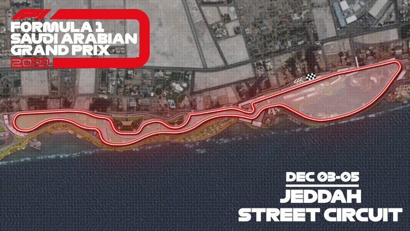
Formula 1™ announced the Saudi Arabian Grand Prix in Jeddah as the new race for the 2021 season.
Organizers claim this will be the fastest ever F1 street circuit, running to 6.175km with 27 corners. The Jeddah Street Circuit will be the second-longest on the calendar and one of the quickest, with an average speed of over 250km/h predicted in simulations.
For me, this track is even more interesting for my Formula 1 Circuits Repository. However, the main issue is that the circuit is only announced, but it doesn’t exist yet. The only official track outline I have is from the image in the press release.
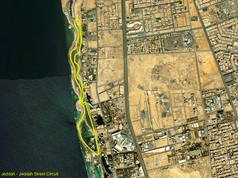
It is a good start, tho. As the first step, I had to georeference that image in QGIS using blurry city shades from the backdrop. In the end, I was satisfied with the result.
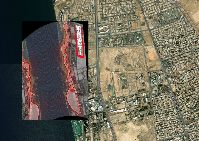
The next step is to digitize the track based on the drawn track outline.
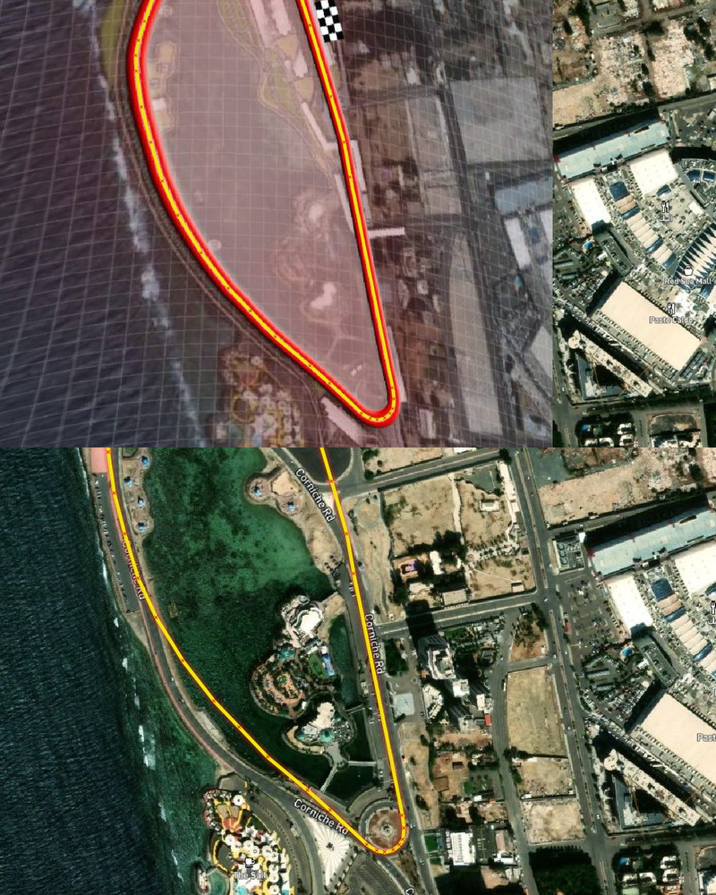
When you remove the georeferenced image, part of the line follows the existing roads. However, some sections are incorrect. Since the track doesn’t exist yet, it is unknown how much the organizers plan to change and adapt to the existing environment to get it as wide as they claim. Therefore, I accept the current outline as good as it is for the time being.
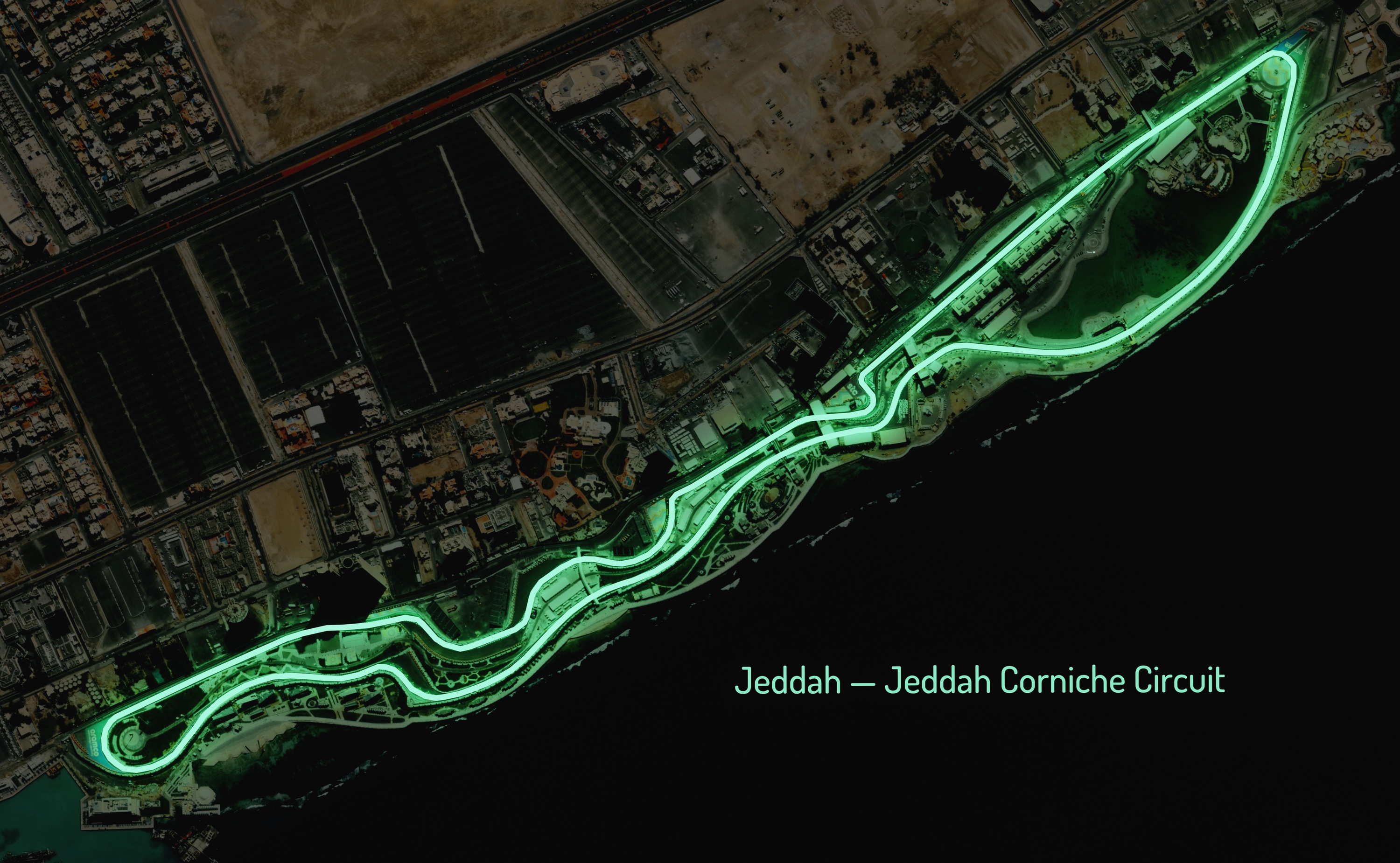
In the end, below is the overlay of the future Jeddah Street Circuit over the satellite image.
If you’ve made it this far because you are interested in vector data, here’s the Jeddah Street Circuit in GeoJSON format.